North Rim
North Rim of Grand Canyon, AZ -- 03-07 July 2007
Here's the trip report from last week's trip to the North Rim
of the Grand Canyon. After great initial enthusiasm, the participants
in the trip were only John H. and his sister Alice B. in the Avalanche.
Did we make the trip: Too long? Too easy? I'll confess that we only
used 4WD for 200 yards out of ~1200 miles. Too scenic? Yes, that
must be it. Too scenic -- My scenery sensors are really fried.
Tuesday, July 3 -- Navajo Bridge, Lee's Ferry
On Tuesday July 3, after picking up A's luggage in Tucson. I drove to
Phoenix to pick up A. hereself. (There had been an airline
misdirection the previous day due to thunderstorms in Dallas.) We
continued on to Flagstaff and north to Lee's Ferry on Hwy 89A. We stopped for
photos at Navajo Bridge, and stopped to stick our toes in the 48degF
Colorado River at Lee's Ferry (while the outside air temperature was
~110 degF). We spent the first night at Cliff Dweller's Lodge a few
miles beyond Lee's Ferry. The lodge is an adequate lodge (reasonably
priced) in a spectacular location, but the restaurant there was itself
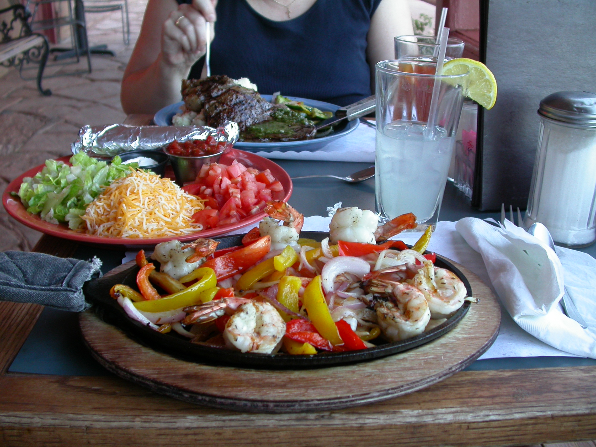
spectacular. Dinner included ribeye steak with garlic smashers, and
shrimp fajitas. For breakfast we had a breakfast burrito and a
"stuffed biscuit" (don't miss this one == a sausage omlette inside two
biscuits smothered in gravy).
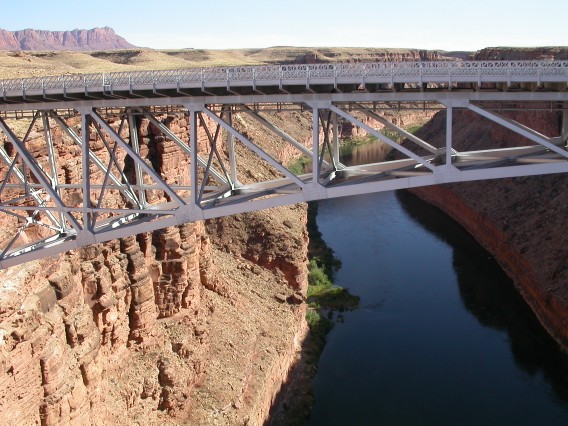
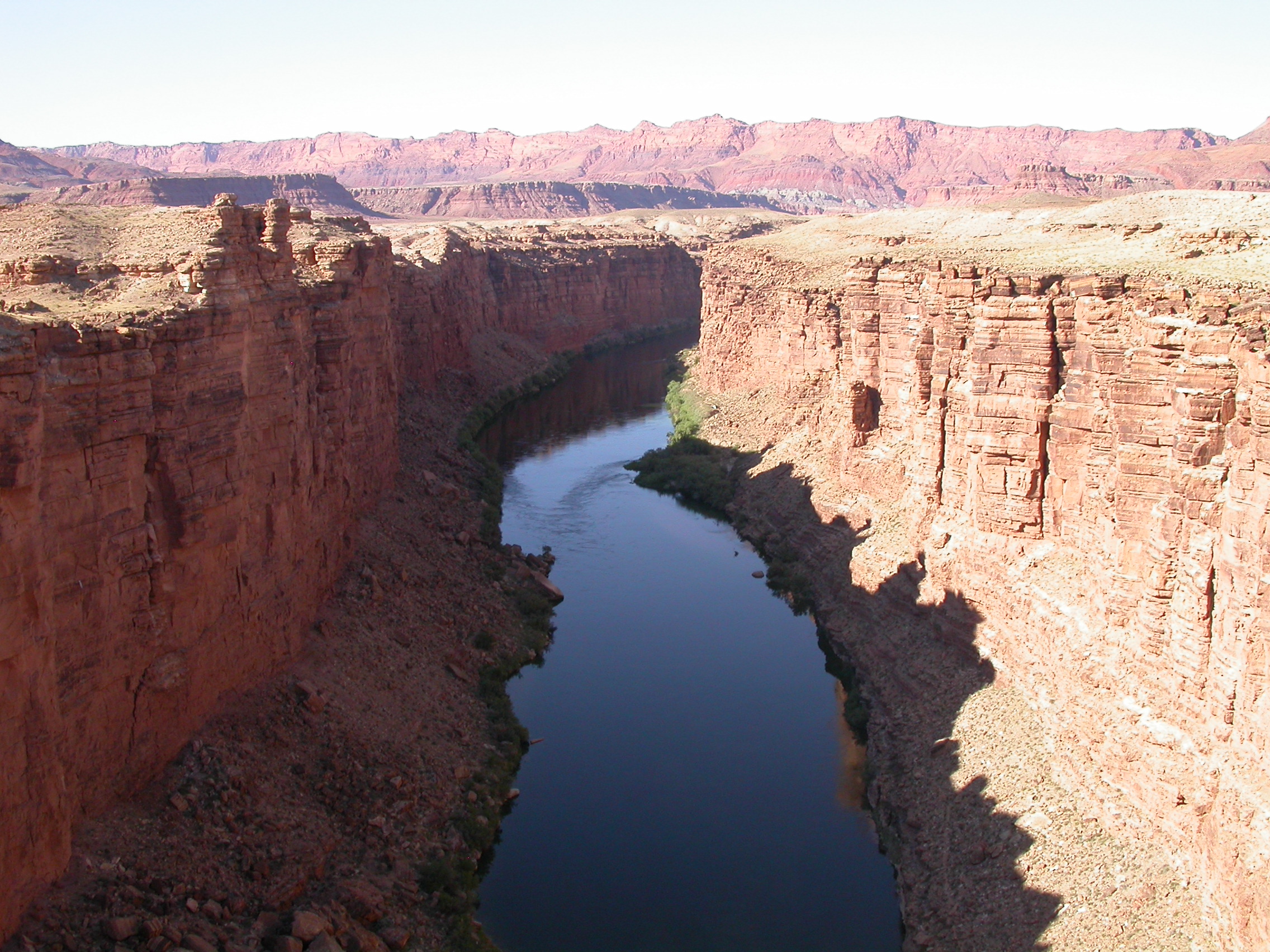
"New" Navajo Bridge as seen from "old" Navajo Bridge.
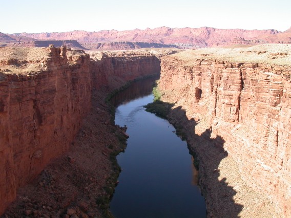
Colorado River looking upstream from Navajo Bridge.
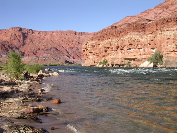
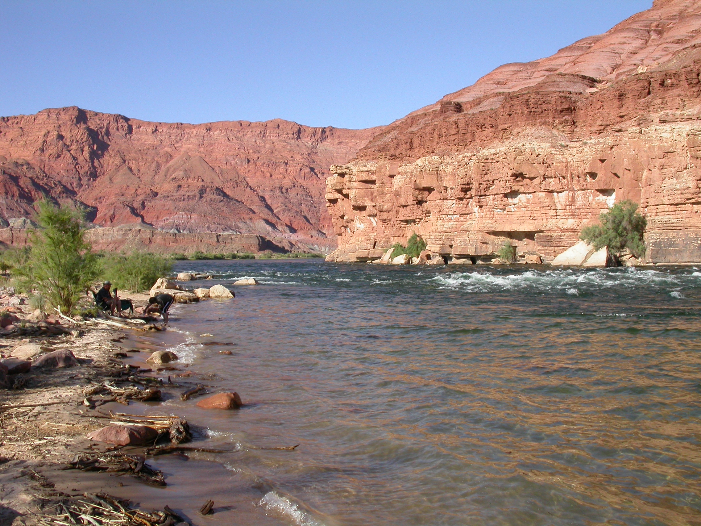
Colorado River from water level at Lee's Ferry.
Tuesday, July 3 - Cliff Dweller's Lodge

Ribeye steak and shrimp fajitas at Cliff Dweller's Lodge.
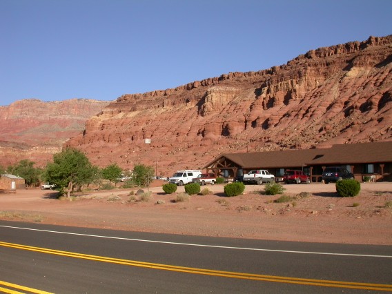
Cliff Dweller's Lodge beneath the Vermillion Cliffs.
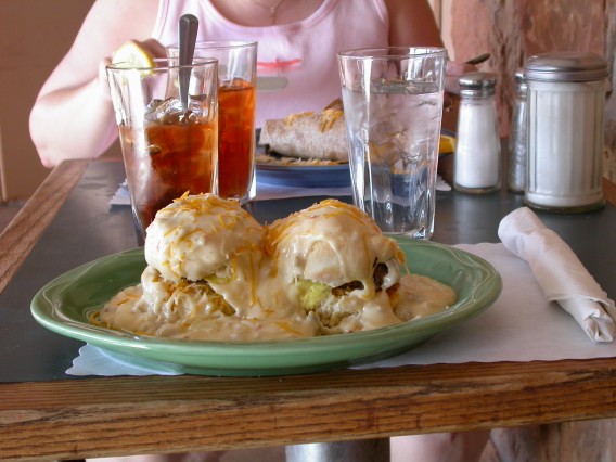
Stuffed Bisuits and Brekfast Burrito at Cliff Dweller's Lodge.
More photos from July 3
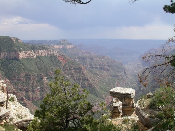
Wednesday, July 4 -- North Rim, Bright Angel Overlook
On Wednesday July 4, we continued on to North Rim proper. The 8000
foot elevation brought the afternoon temperature down to 90 degF
(still setting local records), but it was still plenty warm for hiking
around. We did Bright Angel Overlook, and saw a condor. Then we took
care of our shopping at the Visitor Center and Bookstore. There were
plenty of people at the North Rim, but it wasn't really crowded. We
stopped at the backcountry office to get our camping permit for Point
Sublime the next day. As the sweet ranger lady described the road as
"BAD, BAD, BAD", John only heard "FUN, FUN, FUN". After listening
carefully to ALL her warnings, we finally got the permit. Note for
future reference: the permit capacity of Point Sublime is 11
persons. Then we drove out to Roosevelt Point and Cape Royal/Angel
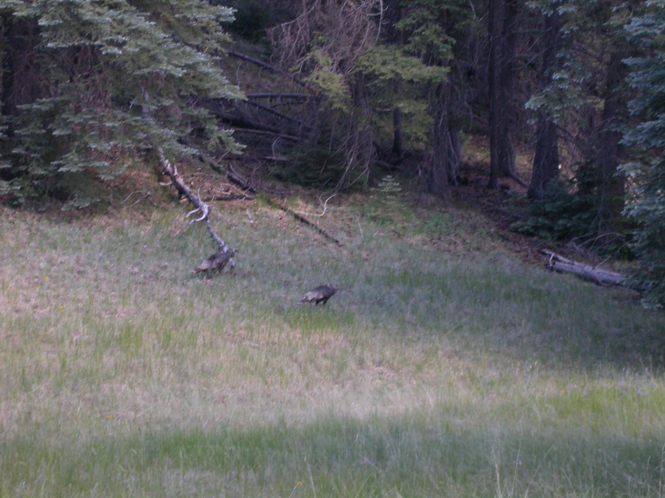
Window (on pavement). The wildlife highlight of the day was seeing
some baby turkeys along the road. That evening we ventured off
pavement to camp at Marble View (in the Kaibab Forest). Despite its
newfound fame in the June 2007 issue of Arizona Highways, Marble View
still had only 5 vehicles camping there on July 4. The dirt road
there is passable by cars or rental RVs. We saw a number of Mule
Deer. The view is spectacular as advertised down into two canyons
(Marble Canyon and North Canyon). Dinner was smoked brisket in Cotton
Jack's BBQ sauce and corn. Breakfast was fried eggs, hickory bacon
and sourdough toast.

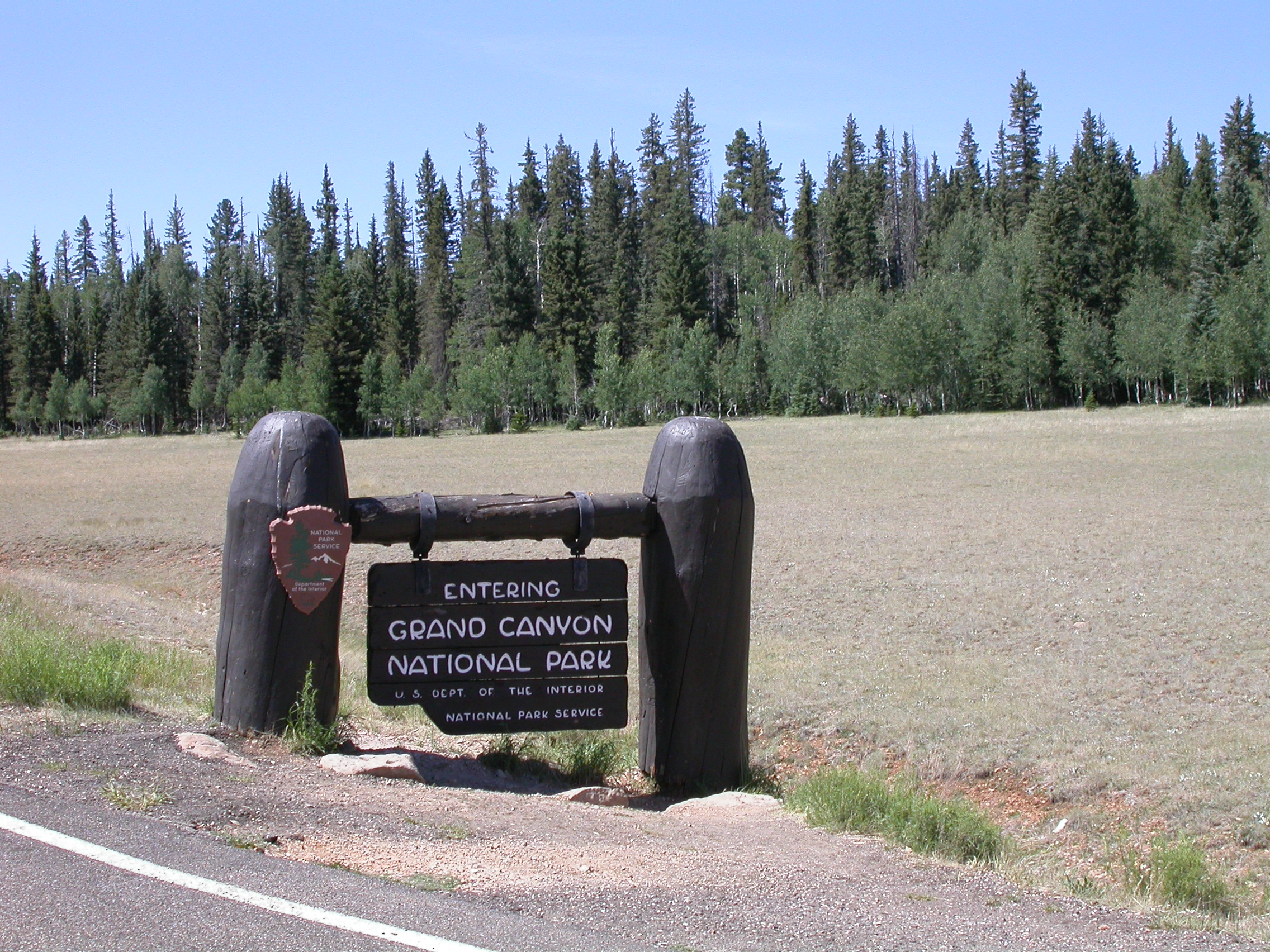
Entering Grand Canyon National Park on Highway 67.
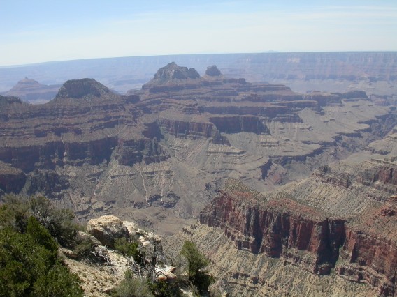
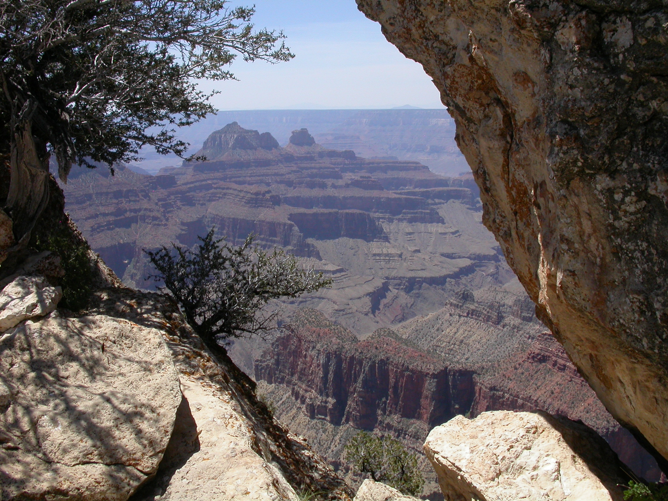
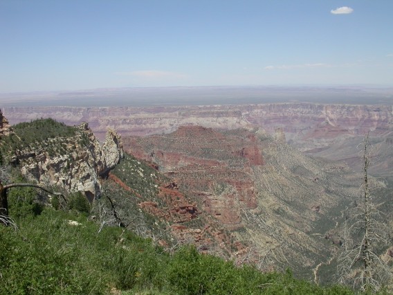
View from Birght Angel Overlook at the North Rim.
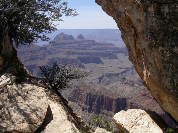
Another view from the Bright Angel Overlook trail.
Wednesday, July 4 -- Roosevelt Point, Cape Royal, Angel Window
Roosevelt Point.
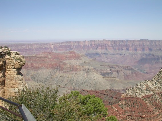
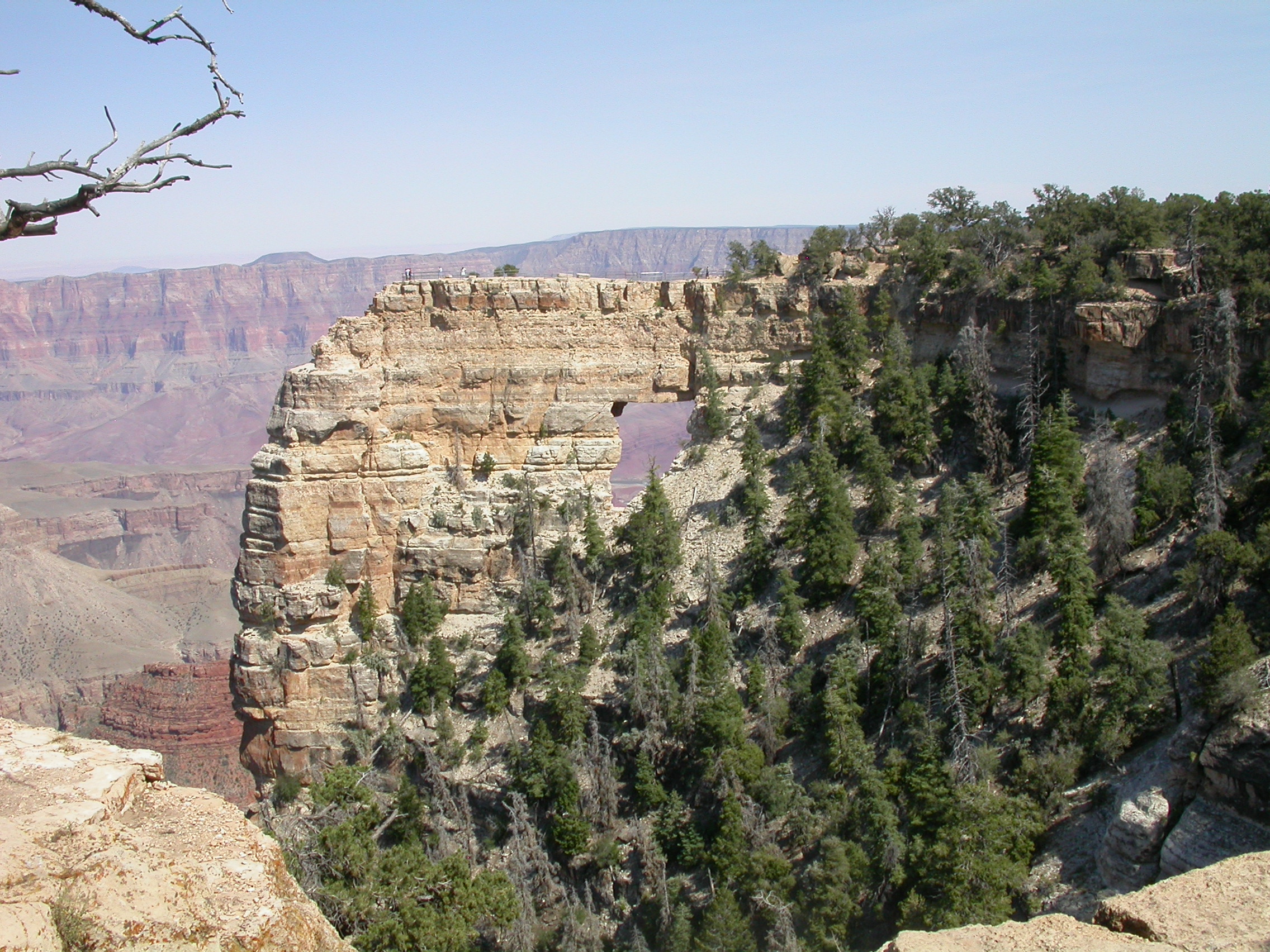
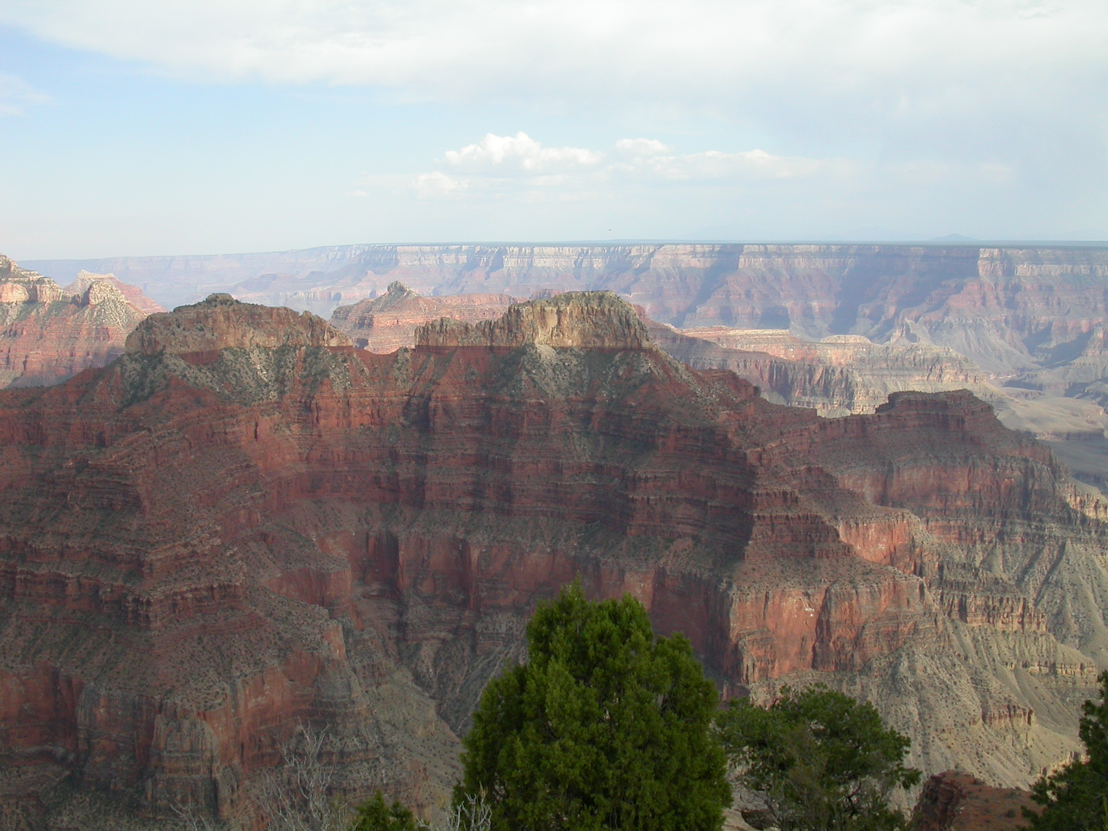
Grand Canyon view from Cape Royal.

View of the river through Angel Window at Cape Royal.
Look carefully to see the baby turkeys in the grass.
Wednesday, July 4 -- Marble View

Looking toward Marble Canyon from Marble View in Kaibab Forest.

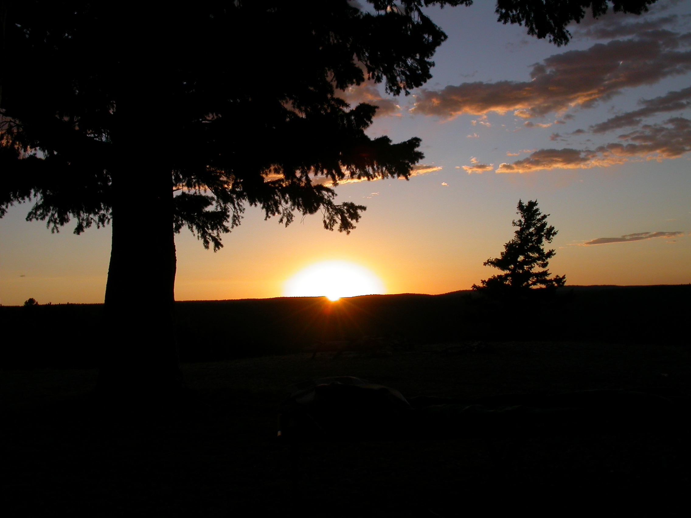
Sunset over North Canyon from our campsite at Marble View.
More photos from July 4
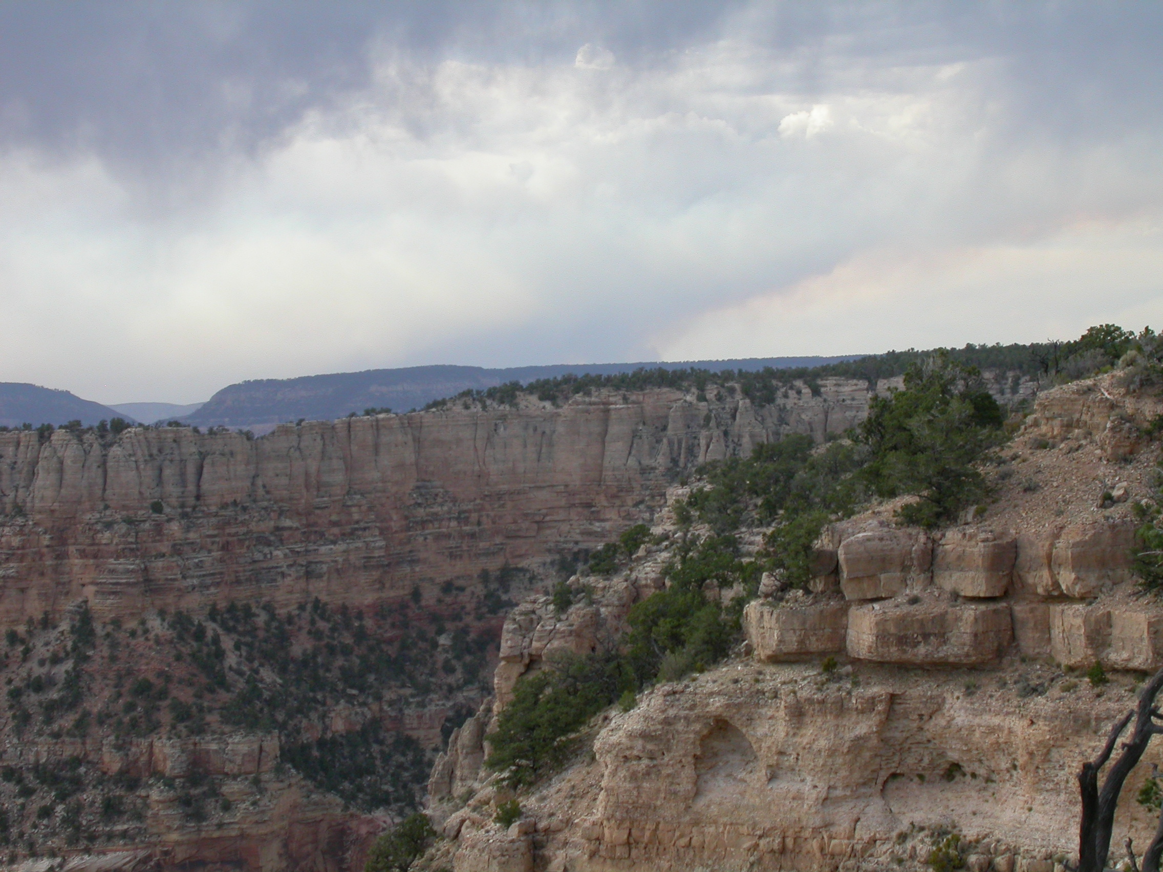
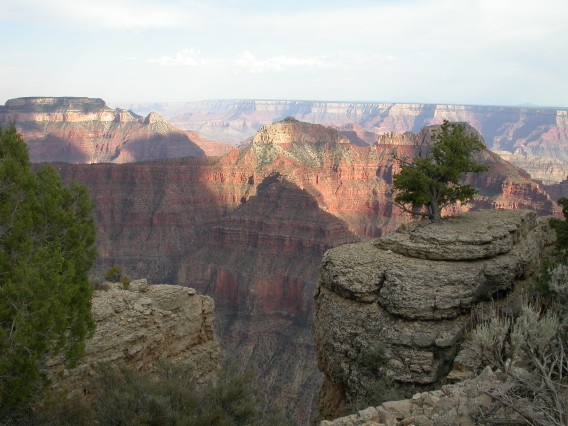
Thursday, July 5 - Saddle Mountain
On Thursday July 5, we visited Saddle Mountain (same road as Marble
View). Then we crossed Hwy 67 and visited Parissawampitts Point and
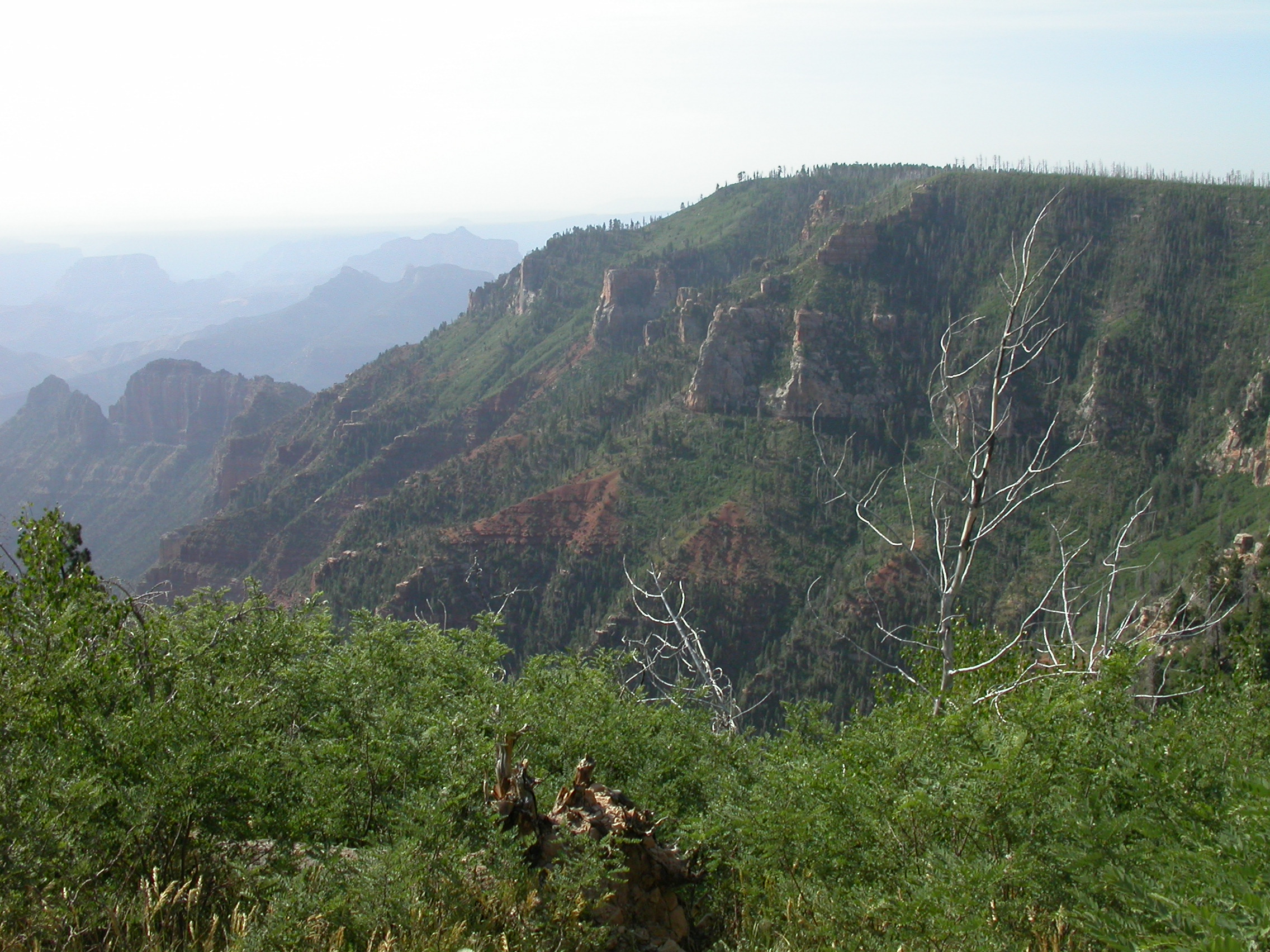
Crazy Jug Point in the national forest. We thought the view from
Crazy Jug Point was the best we had seen, but the day was still young.
Some small thunderstorms started up around noon, so the day was a few
degrees cooler (85 degF). One of these storms lit the "Slide Fire" in
Slide Canyon in the Kaibab forest about 10 miles north of where we
were. We saw it burning in the distance that evening. We were
essentially alone during all this driving through the forest, so all
these points would be fine places to camp. We headed back to the
North Rim for gas and iced tea. Then we headed out the road to Point
Sublime. Turns out that BAD,BAD,BAD and FUN,FUN,FUN were both
exagerrations for this 18 mile road. It took ~2 hours each way as
Wells said it would. There were some sandy holes that could be nasty
in wet weather, and there were some rocks. But any stock 4WD vehicle
could navigate this road with an experienced driver. We got some
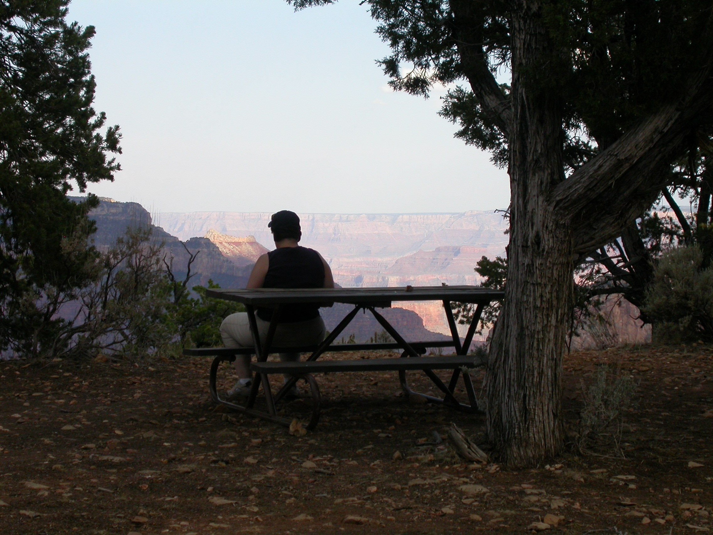
great photos at the Crystal Creek overlook. We arrived at Point
Sublime in late afternoon with thunderstorms drifting across various
parts of the canyon. We met 4 other vehicles coming and going to Point
Sublime, but by 5:30PM we had the place to ourselves. Words are
inadequate to describe Point Sublime. There is a 300+ degree canyon
view, limited only by a few trees and bushes. In good weather, this
is the best camping spot I've ever seen. In bad weather, you'll
likely find it much too exposed. Dinner was red beans & rice with
kielbassa, and mandarin oranges. Breakfast was blueberry pancakes. At
Point Sublime, cooking, eating, brushing your teeth all have a
spectacular view. Even the composting toilet had a bit of a view. We
found Point Sublime much warmer than Marble View at night because of
hot air convecting up from the canyon walls below us. It rained on us
for about 30 seconds during the night, just enough to send me
scurrying to get the tarp for my cot.
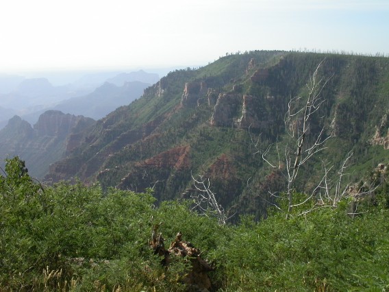
Canyon view near Saddle Mountain in Kaibab Forest.
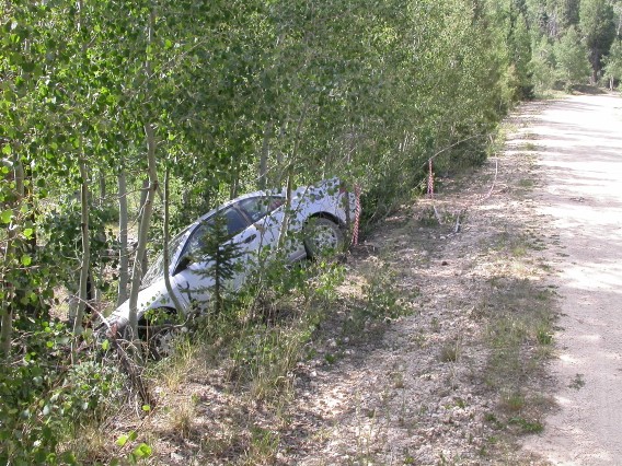
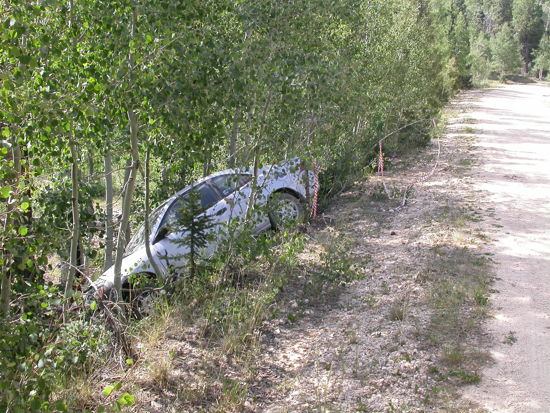
A rental car may not always be a good 4WD vehicle!
Thursday, July 5 - Parissawampitts Point and Crazy Jug Point
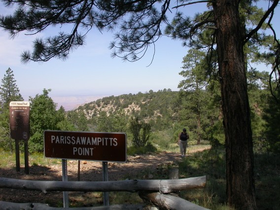
We went to Parissawampitts Point just for the name.
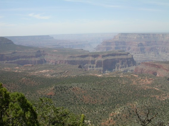
Canyon view from Crazy Jug Point.
Thursday, July 5 - Crystal Creek
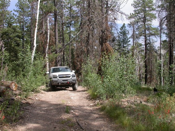
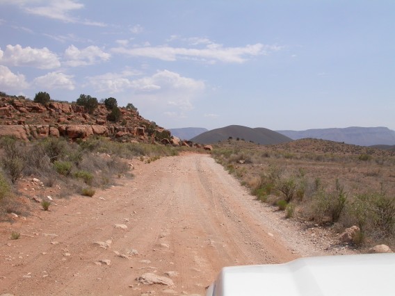
On the road to Point Sublime......
Looking down Crystal Creek on the way to Point Sublime.
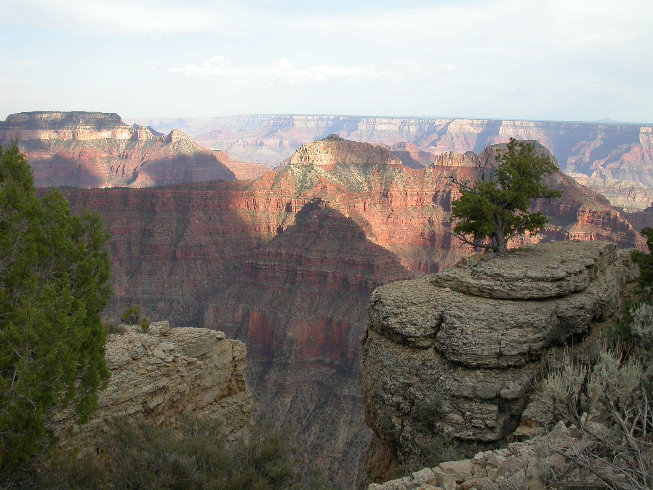
Thursday, July 5 - Point Sublime

Mencius Temple and Confucius Temple from Point Sublime (a. k. a. Two Cats Temple).
Smoke fron the "Slide Fire" as seen from Point Sublime.

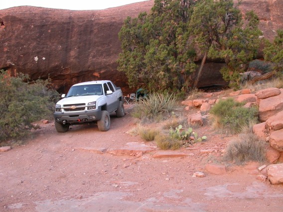
Pretty fine place for a picnic on Point Sublime.
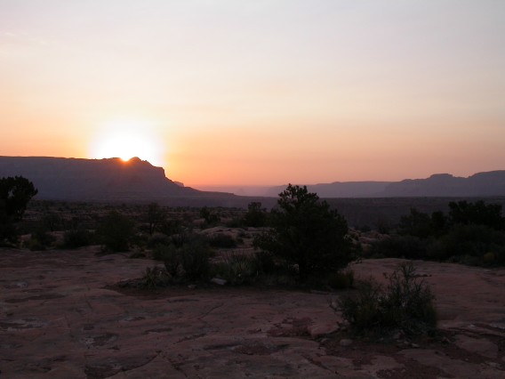
Sunset view from Point Sublime.
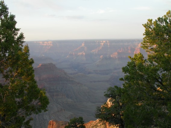
Sunrise view from Point Sublime (what you see while brushing your teeth).
More photos from July 5
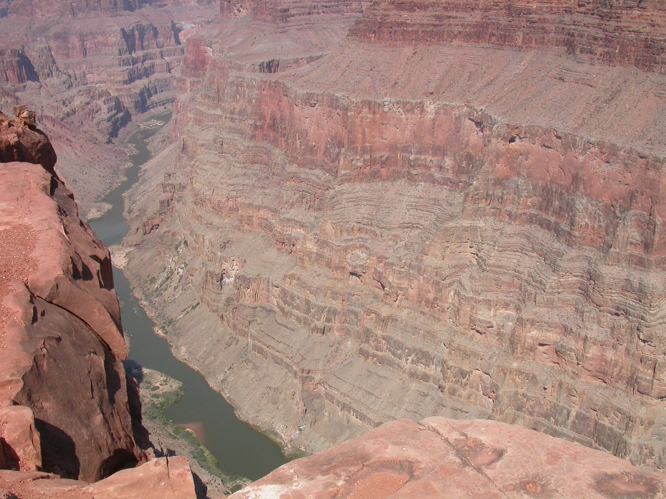
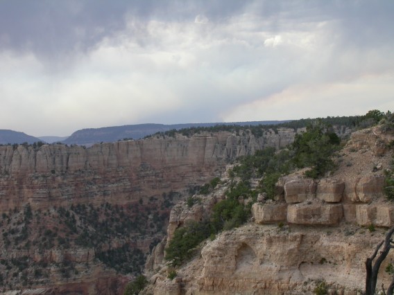
Friday, July 6 - Toroweap
On Friday July 6, we left Point Sublime early in the morning. Two
hills on the way back were eroded from too many open-diff vehicles
going up, so I actually used 4WD for these. The Avalanche easily did
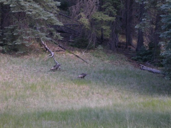
the rest of the road in 2HI. We saw some baby grouse in the forest on
the way back. After getting back to North Rim, we headed for Toroweap
via Fredonia. The 60 miles of dirt road into Toroweap was also well
described by Wells and took ~2.5 hours. You can go 45 mph over the
washboards, but there are enough holes and pits and ruts to make you
focus intently on the road (and occasionally test the ABS). We passed
another wildfire burning NE of Toroweap. Since Toroweap is lower
elevation (4500 feet), it was ~105-110 degF in the afternoon. We were
impressed by the view over the cliff (3000 feet straight down into the
Colorado), then we went to find a campsite in the shade. The two
campsites at the overlook have been converted to day use only, so we
went to find a site at the regular campground about 1 mile from the
overlook. We were able to find a site with a huge rock on the west
side, so we spent the rest of the evening reading in the shade at the
picnic table. Four of the ten sites at the campground were occupied
that night. Dinner was albacore tuna on sourdough bread and pineapple
chunks. Even after sunset, it was hot enough to sleep on the cot
without any sleeping bag or cover. I got up at 3AM to get a towel to
put over my feet as it had cooled to ~75 degF. Breakfast was more
pancakes (they keep well in the heat). A. reports that Toroweap had
superior restrooms compared to our other camping locations (enclosed
composting toilets).
After one more look at the overlook with morning lighting, we left
Toroweap at 7AM. Now I understand that Steve W. spent 4 days there
because it takes that long to get your courage to look down over the
edge! We went out on the road to Colorado City. It is a shorter
distance to pavement, but could be worse in wet weather.
We went west
on 389 and then took the Smithsonian Butte National Backcountry Byway
north toward Zion. We drove through Zion on the highway, but it was
packed with people so we didn't stop other than a couple pullouts on
the road. We stopped for chocolate shakes at "Three Bears" in Kanab,
and then we headed for home. The last photos are from the Glen Canyon
Dam overlook in Page, AZ. The next stop was for "Pig in a Poke" BBQ
in Flagstaff. We passed another wildfire (Birdie) near Mormon Lake.
And when we got back to Tucson, the Alhambra Fire was burning near
Kitt Peak. Since had been on Mt. Graham the previous Saturday
(Chitty), I had been within 40 miles of EACH of the 5 major wildfires
burning in Arizona on July 7. (How's that for a wierd travel
statistic?)
On the road to Toroweap......
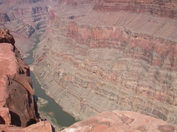
View from the Toroweap Overlook.
Saturday, July 7 - Toroweap at sunrise
Sunrise at Toroweap.
Site #9 in the Toroweap campground.
Saturday, July 7 - Smithsonian Butte Backcountry Byway and Zion National Park
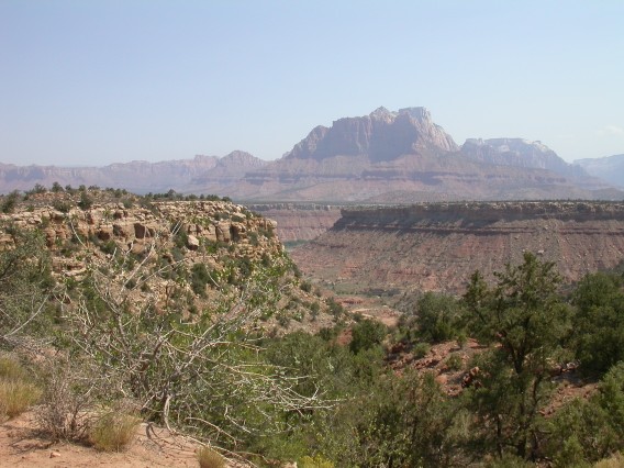
Wire Mesa as seen from the Smithsonian Butte Backcountry Byway.
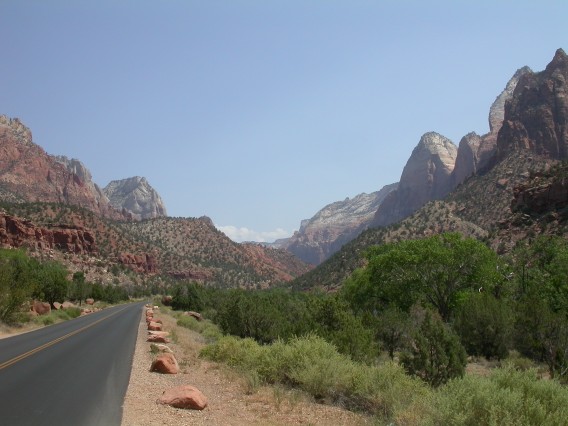
On the way into Zion National Park....
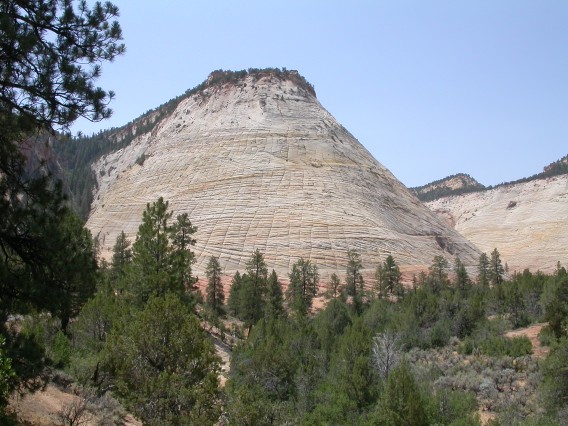
Checkerboard Mesa at Zion National Park.

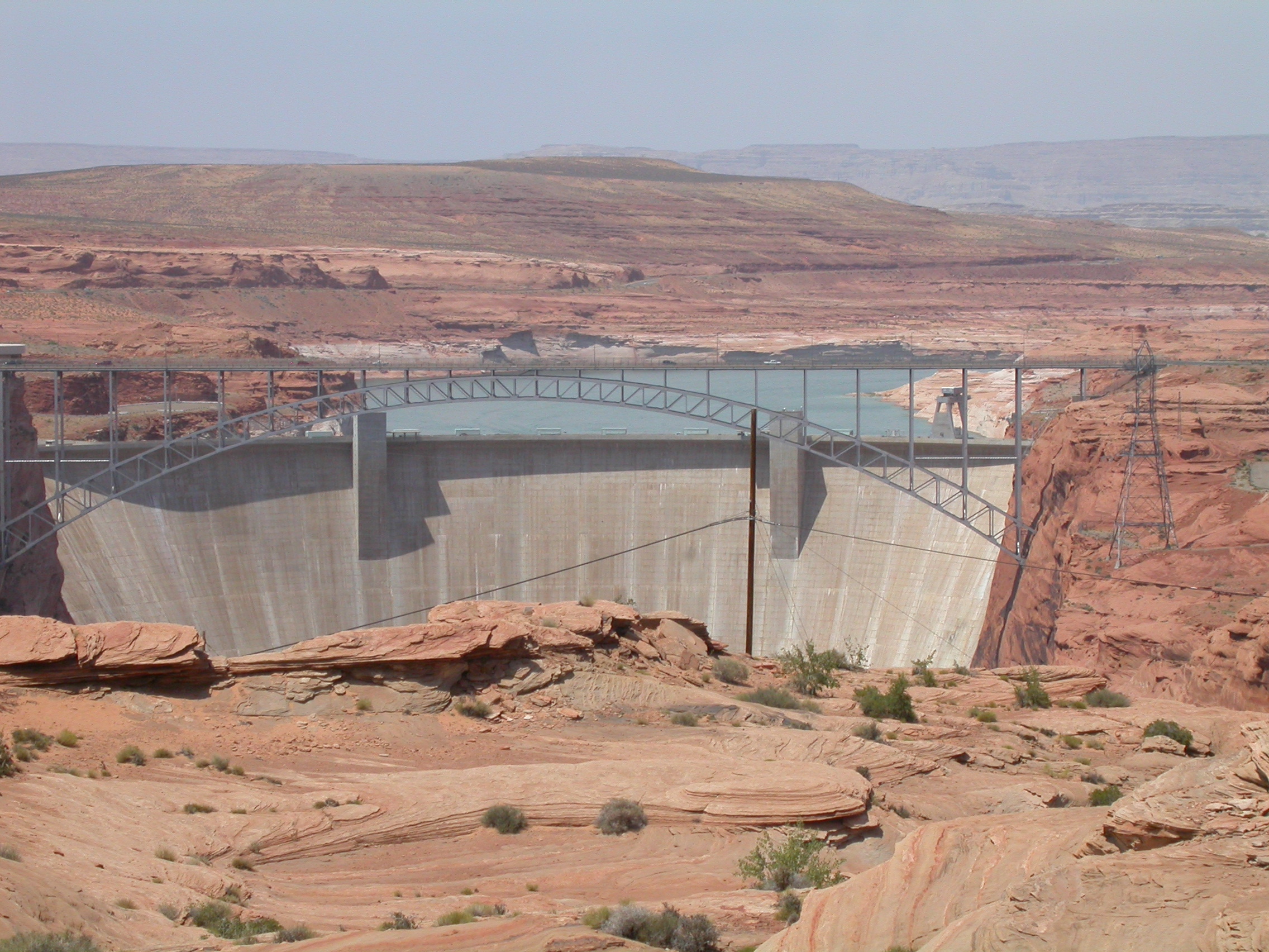
Glen Canyon Dam from the overlook at Page.
More photos from July 6-7
John Hill <jhill@as.arizona.edu>
Last modified: Mon Jul 23 18:53:41 2007