Trail Rating for the Gila Box

Warning: Southeastern Arizona has been very, very dry in early 1996, so access to Eagle Creek and the Gila Box area is relatively easy for a well-equipped 4x4. Beware that travel gets very tricky when the water is higher. Make sure that you go with a friend (or three) and a winch (or two). Most spring seasons would require a boat rather than a truck to visit the Gila Box.

The first few miles upstream from the Bonita Creek trailhead are easy going, but the crossings get softer and deeper as you proceed up the Gila. In the dry season, the trail rating going upstream is 3.5 at the start increasing to 4.0 as you near the confluence of the San Francisco River. Make that 4.5 if you proceed into the mud flats above the San Francisco. Subtract half a point for coming back downstream. Add half a point for each additional 6-inches of water running in the river or each additional 30 CFS of flow. (The reference level for the above ratings is 18-inches deep on the first crossing above Bonita Creek when the flow is about 90 CFS.) Stock 4x4s can make the trip with assistance along with wide tires and low air pressure. The only obstacles are soft sand and deep water. When in doubt about where to cross, the best place is usually at the top of a riffle where the silt has washed away. Always walk across questionable crossings first --- if your feet sink in the mud, so will your truck.

Trail Location for Gila Box

Travel time from Tucson is 2:30 hours. From Safford, on US 70 West (in town) turn North on 8th Ave. and cross the bridge over the dry Gila. All the water is usually in an irrigation canal at this point --- if water is flowing under the 8th Ave. bridge, the Gila Box may be too deep to access. After the bridge turn right on the road to the Safford Airport (Airport Road). Turn left at the "T" after the airport onto Sanchez Road. (Alternately you could have taken Sanchez Road North from US 70 at Solomon and crossed the new bridge over the Gila.) Follow Sanchez Road Northeast until the pavement turns to gravel just before you enter the
Gila Box Riparian National Conservation Area. Turn left soon after the pavement ends and turn right at the second fork, and right at the third fork, and finally turn left. You are trying to get to the Gila River access and camping area at Bonita Creek near the Serna Cabin picnic area, but beware that there are signs to other campgrounds and other river accesses. Follow Bonita Creek for the last 100 yards down to the Gila, then turn left upstream. The first crossing of the Gila happens almost immediately.

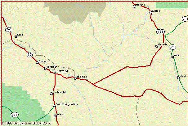
Area Map for Gila Box from MapQuest

Gila River Flow Rate

Our successful navigations of the Gila Box have been at streamflow rates (e.g. September 1995) of less than 110 CFS as measured on the Gila River at the head of Safford Valley near Solomon (the outlet of the Gila Box plus Bonita Creek). The USGS Water Resources Information for Arizona page provides historical data and on-line flow data retrieved via satellite for the Gila River near Solomon and the Gila River near Clifton and the San Francisco River at Clifton and Eagle Creek near Morenci.

Topographic Maps Needed

Lone Star Mountain, Gila Box, Guthrie, Copperplate Gulch, Clifton

Adjoining Topographic Maps

GPS Coordinates

Landmark UTM Easting UTM Northing Altitude
Safford (Hwy 70 & Hwy 191) 12 6 21 000 E 36 33 480 N +2915
Solomon (Hwy 70 & Sanchez Road) 12 6 28 240 E 36 31 600 N +2969
Bonita Creek at the Gila River 12 6 42 400 E 36 40 300 N +3170
Eagle Creek at the Gila River 12 6 49 000 E 36 47 800 N +3300
San Francisco River at the Gila River 12 6 52 150 E 36 46 700 N +3350
San Franciso River trailhead 12 6 57 400 E 36 53 250 N +3400
Old Safford Road crosses the Gila River 12 6 58 100 E 36 48 500 N +3373
Clifton (Hwy 191 @ San Francisco River) 12 6 59 200 E 36 57 900 N +3480
Morenci (X Hwy 191) 12 6 56 720 E 36 58 200 N +4030


Vehicle Access to the Gila Box Prohibitted

July 1999 BLM Press Release about the posted closure of the Gila Box Riparian National Conservation Area. See also the February 1998 BLM Press Release about the proposed management plan which excludes off-road vehicles from the entire Gila Box.


This web page maintained by
John M. Hill <jhill@as.arizona.edu>
Steward 4x4 page

Last modified: Thu Jun 25 16:05:40 2009