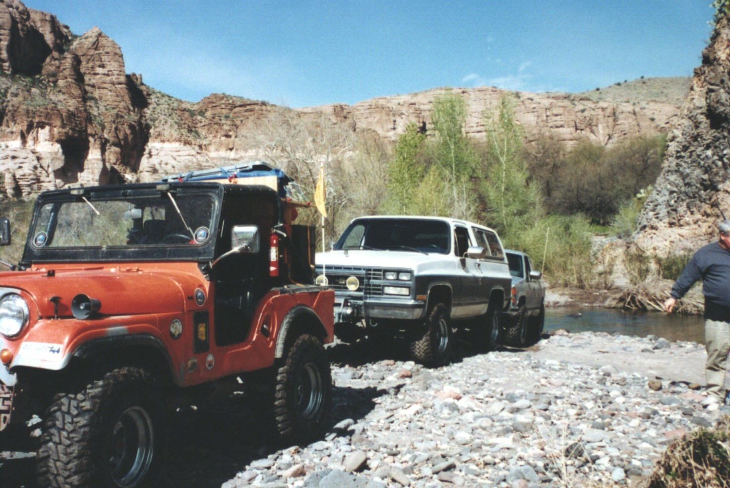
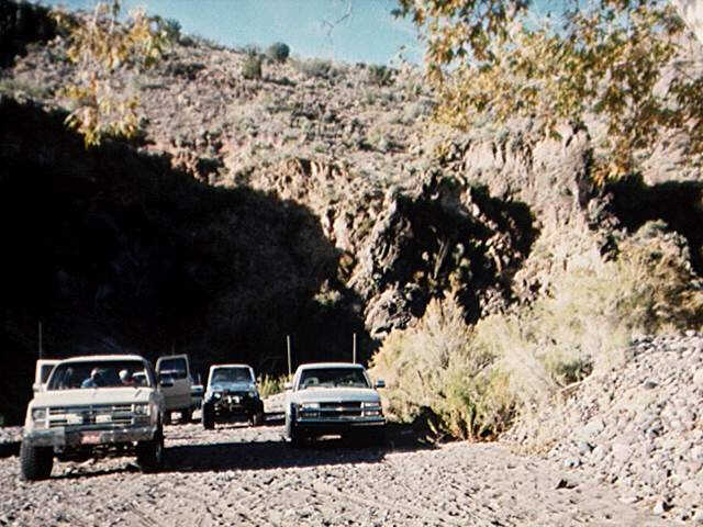
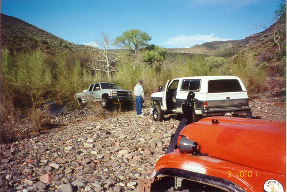
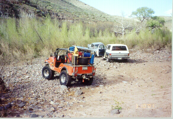
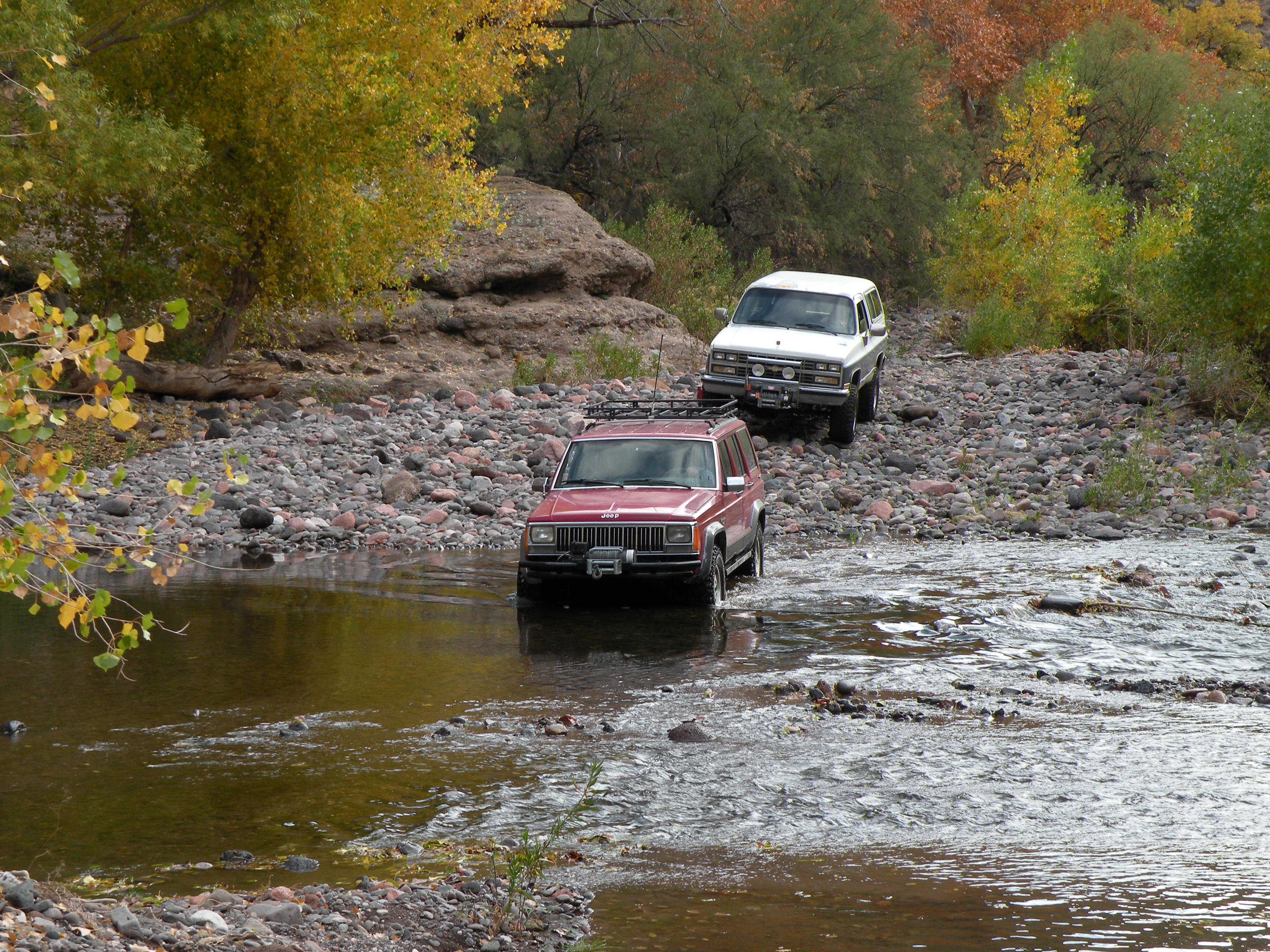
Here's a trip report on the 4x4 trip we took down Eagle Creek on Saturday and Sunday November 11-12, 1995. Participants included Bob Peterson and Bobby in Bob's 87 Chevy Suburban (lifted, rear locker, 33-inch tires), John Hill in his 94 Chevy K2500 extended cab (31-inch tires, XD9000 winch), Jeff Rill in his 86 Toyota extended cab (rear locker, 31-inch tires) and John Waack in his Suzuki Samurai (front and rear lockers, 33-inch tires, rock lobster gears).
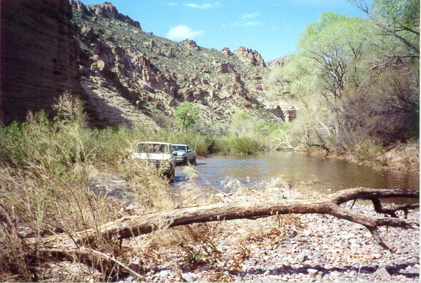
After breakfast in Safford and the Veteran's Day parade in Clifton, we entered Eagle Creek just east of Morenci, AZ on Saturday afternoon and headed downstream. We drove about 10 miles and camped about 1.4 miles from where Eagle Creek joins the Gila River. On Sunday morning we continued the trip down to the Gila. Seeing that the Gila was running a few inches higher than on our previous adventure (and not looking for that much more adventure), we backtracked up Eagle Creek on Sunday afternoon.
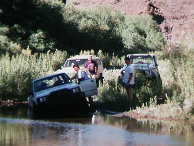
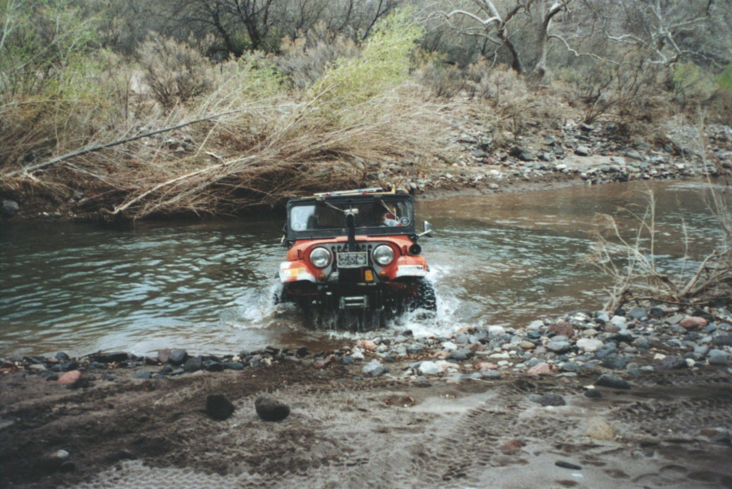
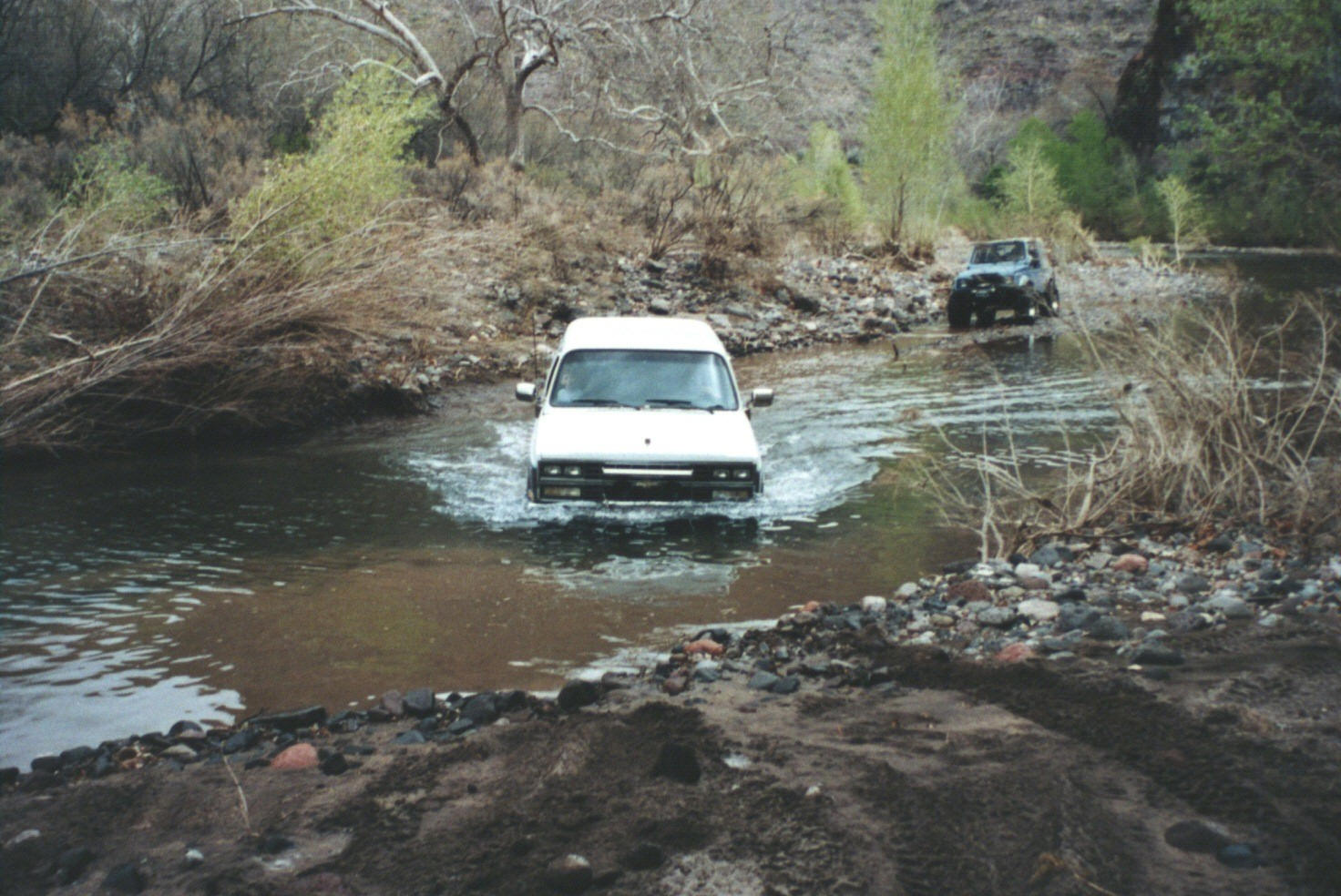
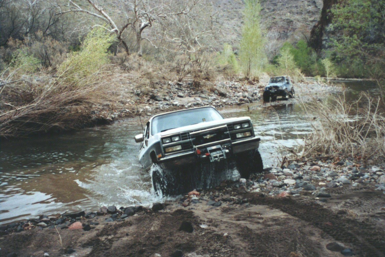
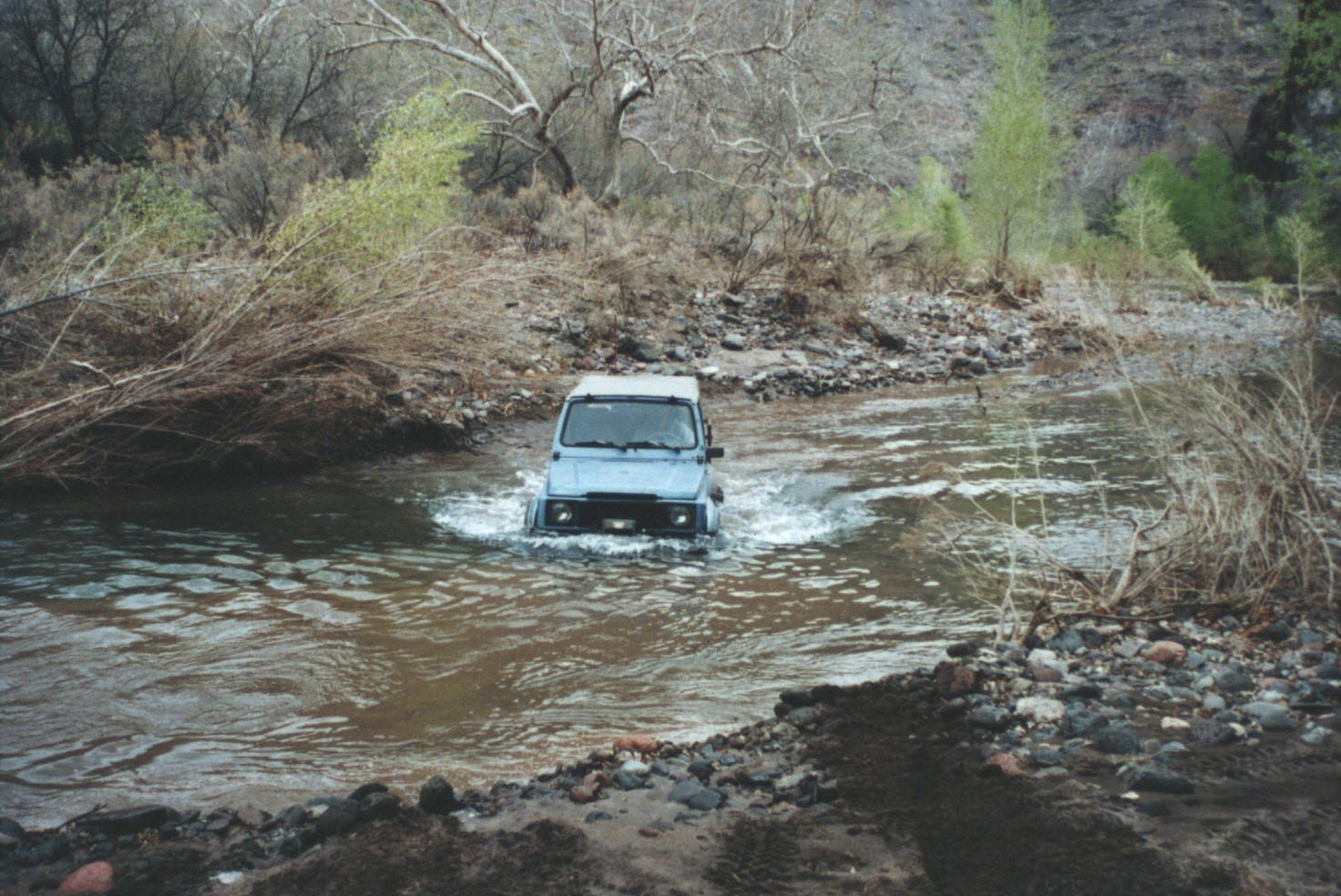
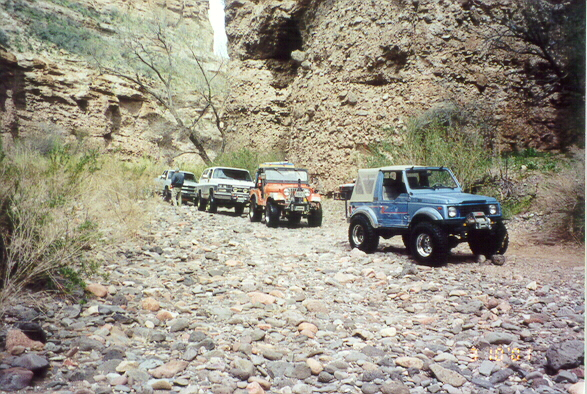
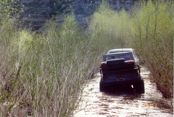
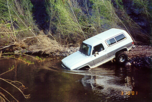
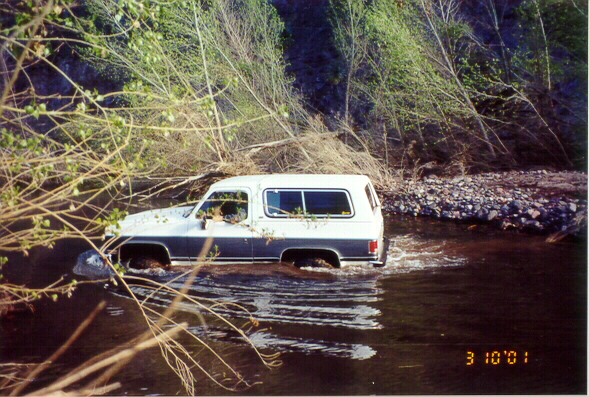
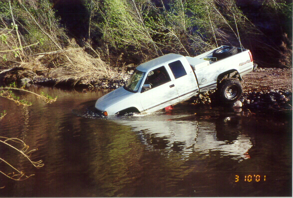
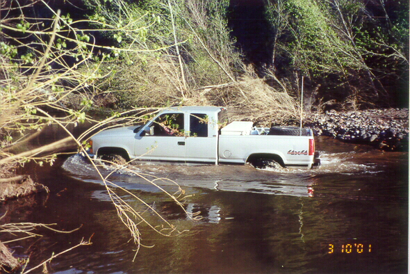
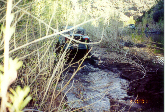
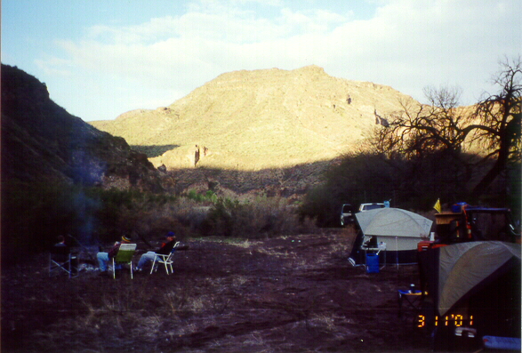
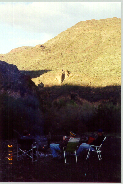
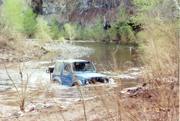
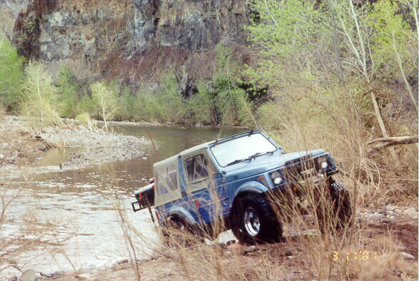
Compared to the previous river running expeditions on the Gila, this was a rather tame trip. The first few miles were easy going, but the going got rougher as we approached the Gila. Sand along Eagle Creek ranges from fine silt to volleyball-sized particles. We never forded water more than 20 inches deep. We never even needed the winches (so where's the fun you ask?), although the tow straps did come out several times (just wait for the photos!). Speed and comfort were limited by the extended boulder fields that we had to drive across. Most of the wheelin' fun was on Sunday climbing banks of sand, gravel and boulders going upstream. Stock vehicles could make this trip without much trouble as long as they have a friend with lockers to pull them out of the sand. Camping under the stars on a sandbar along the creek was lovely --- its always nicer when you bring food and camping equipment. There were some real thrills as wet river rocks started exploding underneath the campfire.
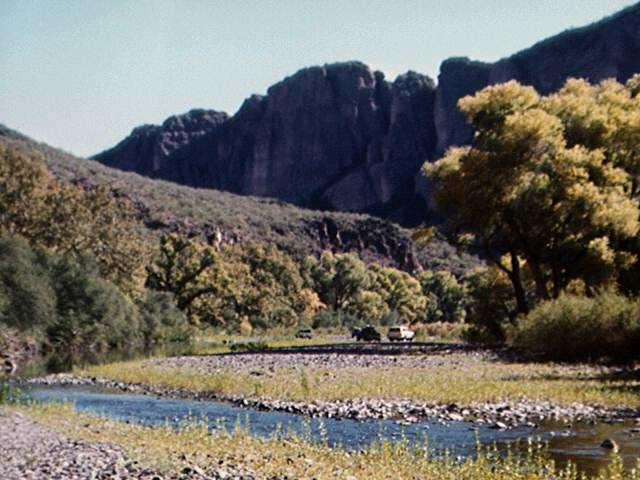
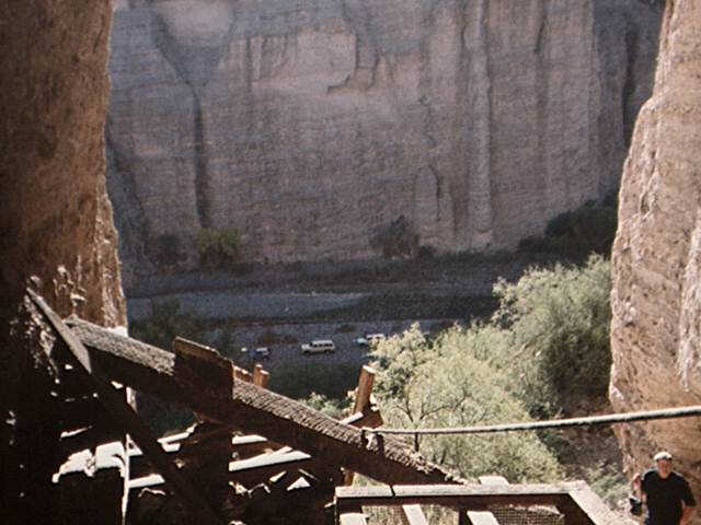
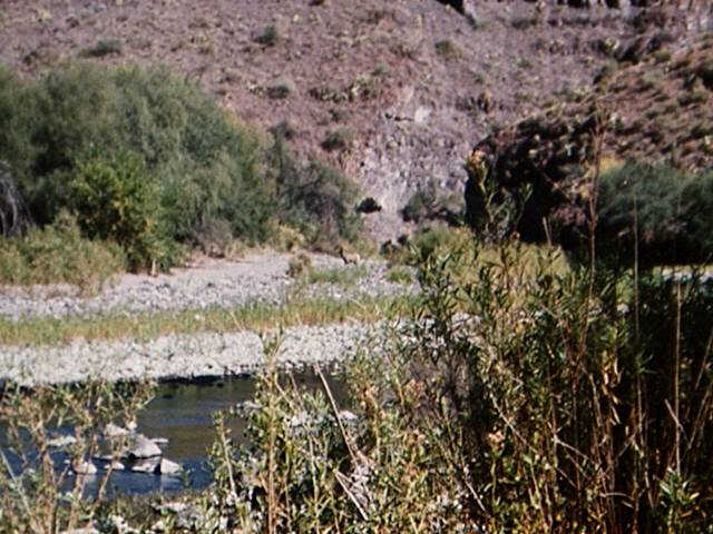
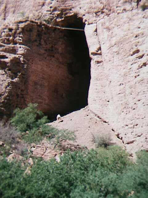
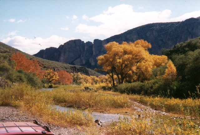
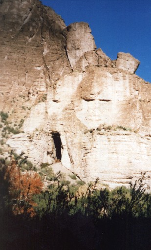
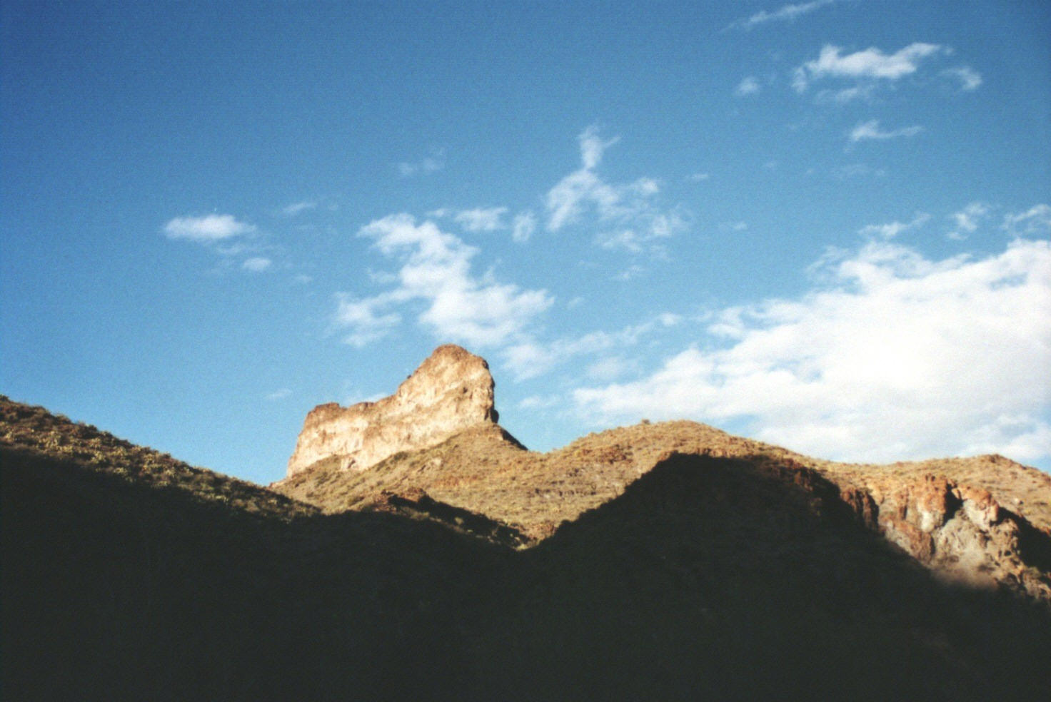
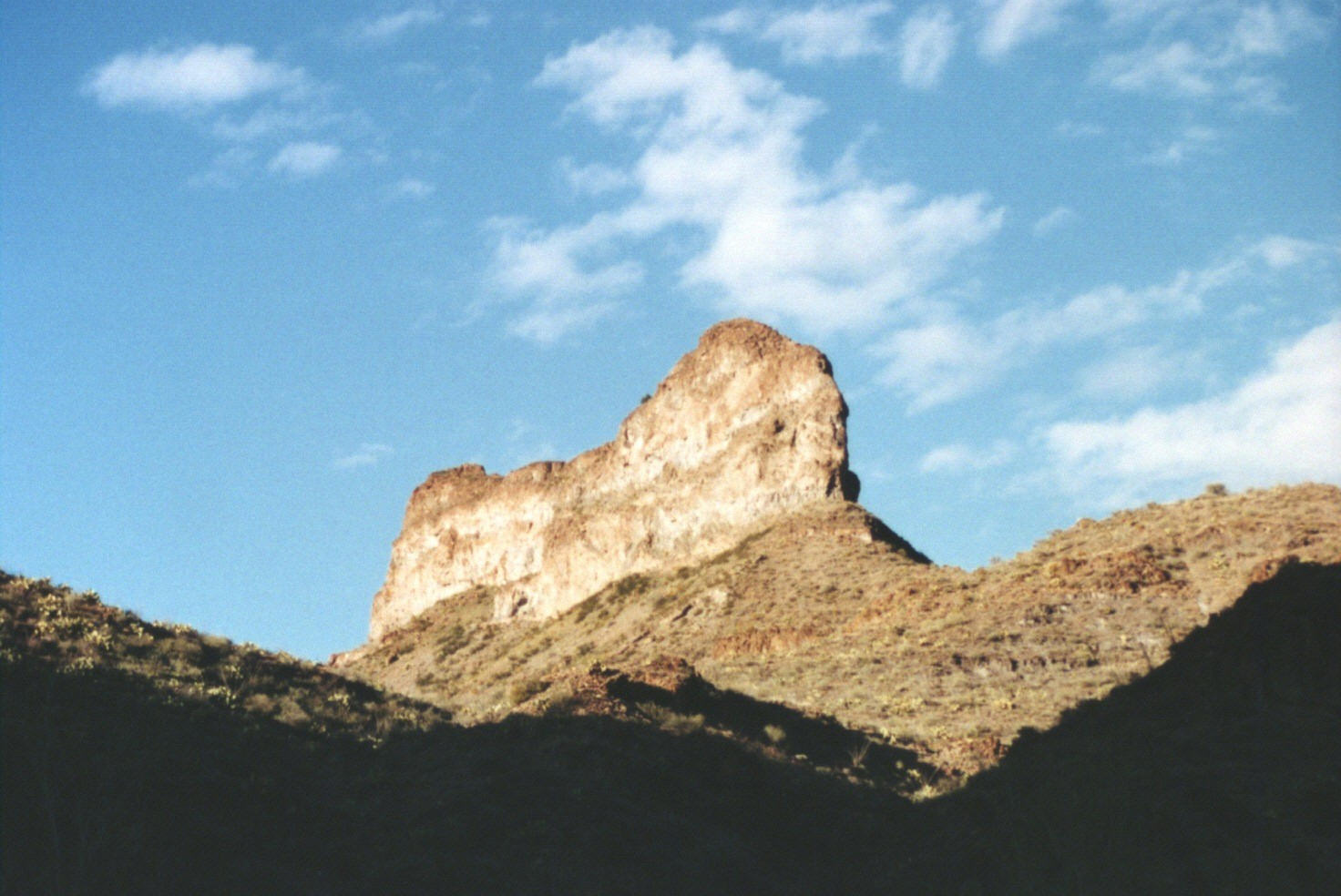
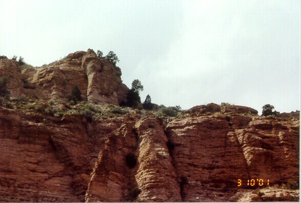
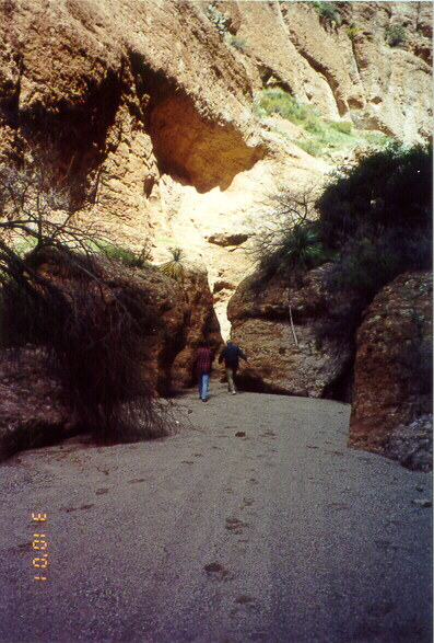
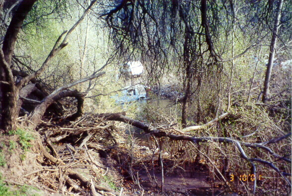
Scenery along the way was SPECTACULAR as Eagle Creek has carved out quite a deep canyon over most of this route. The natural beauty of the rocks was further enhanced by the colors of the fall leaves as the cottonwood and walnut trees turned yellow. We stopped to explore a bat cave on Saturday afternoon. A visit of only a few minutes was plenty to convince you that hundreds of tons of bat guano . The view down from the bat cave was also quite impressive. We also passed a number of old homesteads and grave sites along the creek. We explored some hot springs and waterfalls on Sunday afternoon.
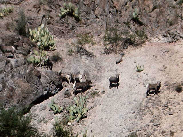
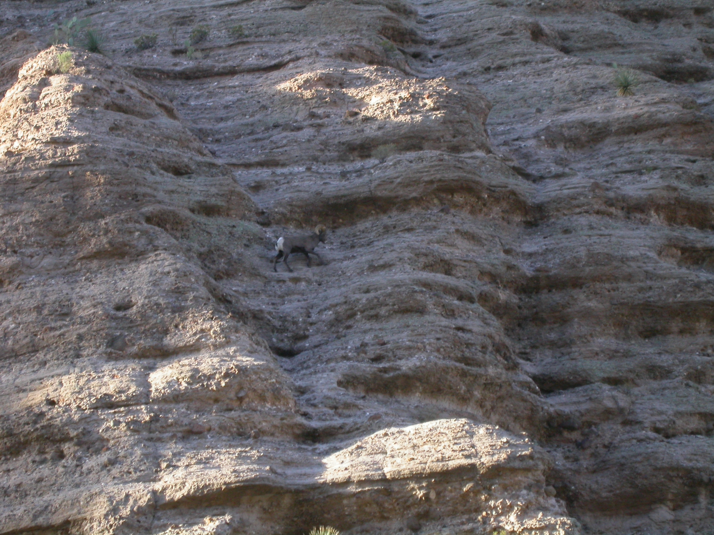
Wildlife was clearly the highlight of this trip. We saw about 10 bald eagles --- I guess that is why they call it Eagle Creek! These birds are very impressive looking as they soar overhead with the November sun reflecting from the white feathers. Apparently these are quite well-fed eagles as the creek is loaded with catfish and suckers. We also saw 13 bighorn sheep from distances ranging from 60 to 250 yards. We didn't see the big herd that we saw in September, but we got to see some rams with some very impressive horns. There was one ram standing right in the middle of the trail who was seriously thinking about chasing out out of "his river". I guess he finally gave up as he was outnumbered. There might have been a serious confrontation if any of us had been driving Dodge (Ram) trucks. As we drove by another group of sheep we were taking pictures and looking at them in binoculars, you could tell the sheep were up there on the cliff, saying to themselves "Look, 4-wheelers --- get the camera. Did you bring the binoculars?".
Here's the trip report for our trip to Eagle Creek over this past weekend May 18 and 19th, 1996. Bob Peterson with Anna, Robby and Curt Blair in "Willy", John Waack in "Over Easy", John Hill in "The River ..... runs through it" (now lifted with 35-inch tires), Kirk O'Laughlin and dogs in his Toyota, and "GaryDog" and Sue in their Toyota drove to Morenci in their Toyota all drove to Morenci on Saturday morning. After a nice Mexican lunch at the Kopper Kettle, we headed down Eagle Creek on Saturday afternoon. We had a lovely drive down Eagle Creek and its scenic canyon. The river was pretty low and our favorite waterfall in a side canyon was just a trickle. We stopped for a very quick visit to the Bat Cave --- "Holy Guano, Batman!". Gary and Curt who had not previously visited the bat cave climbed up to take in the ambiance. We saw a group of about six bighorn sheep including a couple lambs grazing along the creek bottom. Since we had to use the winch and/or tow strap to extract a couple trucks from the quicksand, it was a proper wheelin' trip. A small delay was encountered when the Toyotas sucked some water into their air cleaners. This problem was rectified by removing the low hanging air intake scoops.
We camped on the beach where Eagle Creek meets the Gila River. Camping was quite nice as the weather was pleasantly warm. On Sunday morning, we drove 2 miles up the Gila to where the San Francisco River flows into it. We had a commemorative visit to the Gila Tranny Shop. John and Kirk enjoyed a brisk swim in a deep hole. We drove back down the Gila through the Gila Box to the access road at Bonita Creek. Since the Gila was about 6" lower than during our adventures last September, the river crossings were all quite easy. We made it back to Safford for another big Mexican lunch at El Chalo.
Here's the trip report for our trip to Eagle Creek over this past weekend November 28-29, 1997. We met at Houghton & I-10 at 8AM on Friday November 28. Despite a cold and wet weather forecast earlier in the week, the day dawned bright and sunny. 13 people in 7 vehicles made the 3-hour drive to Morenci. This was a Tucson Rough Riders trip, but the crowd was heavily populated with astronomers and geologists. The mexican lunch at the Kopper Kettle was cancelled because the restaurant was closed, but I'm sure we all ate enough on Thursday to tide us over.
We drove down into Eagle Creek from the access East (North) of Morenci which is maintained by Phelps Dodge. Those who were skeptical about why we would drive 170 miles for 10 miles of wheelin' were immediately convinced by the scenery in Eagle Creek where Gold Gulch enters it at the Pumping Station. Besides the usual rocks and cliffs, the cottonwood trees were at their peak golden color. It's about 10 miles to the intersection of Eagle Creek and the Gila River where we camped on the dunes overnight. The first 7 miles are easy going as much of this trail has been graded. Eagle Creek was running at about 40 CFS, so the river crossings were relatively easy and shallow. The last three miles of the trail get rougher and more obscure (rating 3.5). Since our last trip in May 1996 the river bottom has become much more heavily forested with willow and cottonwood seedlings.
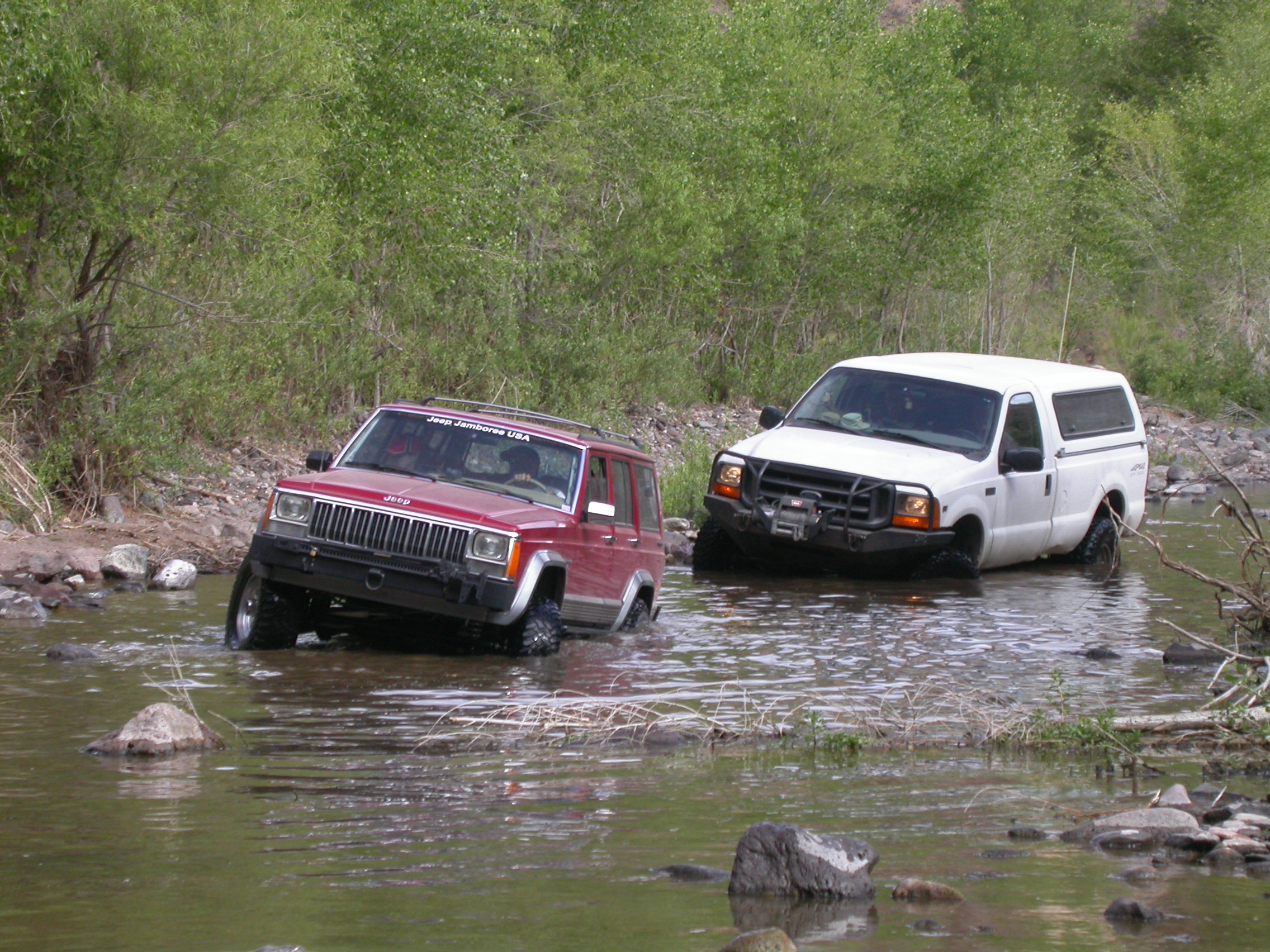
Despite having several stock vehicles along, we only had to use the tow strap once. A Jeep Grand Cherokee was swamped in about 2.5 feet of water after he followed the trail leader through a deep hole that wasn't really the trail. The good news is that the Cherokee has plenty of drain holes. The bad news is that they work in both directions. No vehicle breakage happened on this trip, nor did we get to exercise the winches.
We arrived at the confluence of Eagle Creek and the Gila River about an hour before sunset on Friday. Camping under a clear dark sky was excellent. With frost on the ground in the morning, the temperature was optimum to appreciate sitting around the campfire. Since the Gila River was running at 220 CFS --- too high to drive through --- we retraced our steps back up Eagle Creek on Saturday morning.
We wound up seeing a total of 30 bighorn sheep and 2 eagles. None of the sheep encounters were up-close-and-personal as they were usually high up on the cliffs at a distance of about 200 yards. The heavy brush along the river has really reduced the chance of seeing sheep at a close distance.
After a stop at the bat cave and at some random ruins, we left Eagle Creek via Guswedt Canyon. We followed a very steep but freshly graded (graded does not imply smooth) road cross-country to Turtle Mountain and then down into Bonita Creek. This two-hour-plus drive brought us back to pavement at about 5PM. Some of the participants finished the trip with a Mexican dinner at Roberto's in Thatcher. Everyone agreed that this was a fabulous trip. Too bad that we were too far down in the canyon to hear UA's football victory over ASU on Friday evening.
Total Highway Miles: 350
Total Off-Road Miles: 35
Here's the 4-wheelin' trip report from our overnight trip to Eagle Creek over the weekend of November 13-14, 1999. It was nearly the perfect trip. The weather was crystal clear, and with highs near 80 and lows near 50 you couldn't pick a better temperature. We saw a herd of 35 bighorn sheep from 200 yards away on the cliffs above Eagle Creek. We had winching --- every good trip needs a little winching. We did field repairs of several vehicles. We had steaks grilled over a bed of mesquite coals --- winching really works up your appetite. So what wasn't perfect? We didn't see any bald eagles. Apparently the weather is warm enough that they haven't moved this far south yet. And a local told us that smallmouth bass in excess of 3 pounds inhabit the deep pools of Eagle Creek. So the next trip needs to include a few hours for fishing and some fresh bass filets to go with the steaks.
The participants were John H. in "The River...Runs Through It" (94 K2500 Chevy P/U), Bob and Robie P. in the venerable "Free Willy" (87 Chevy Suburban), Rick M. in his Toyota 4Runner, John W. and Skip B. in "that Weenie Chevy" (S-10 Blazer), Ed McC. and Jeff in a '99 Ford F-250 Super Duty, and Mike D. and Amy P. in his Jeep Cherokee with newly installed locker.
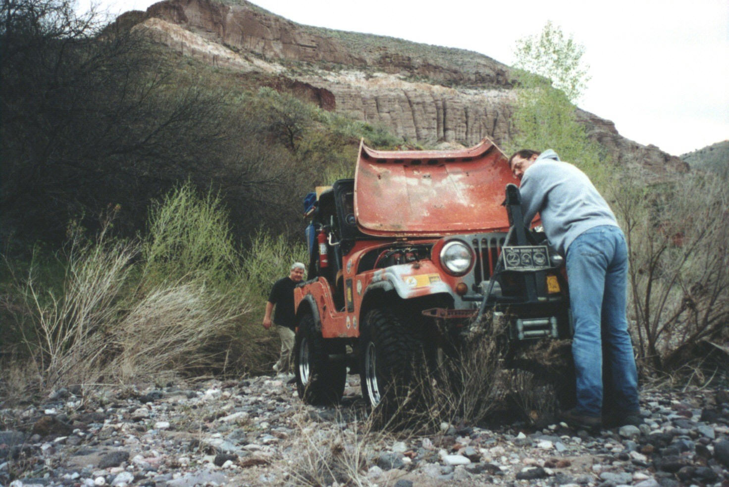
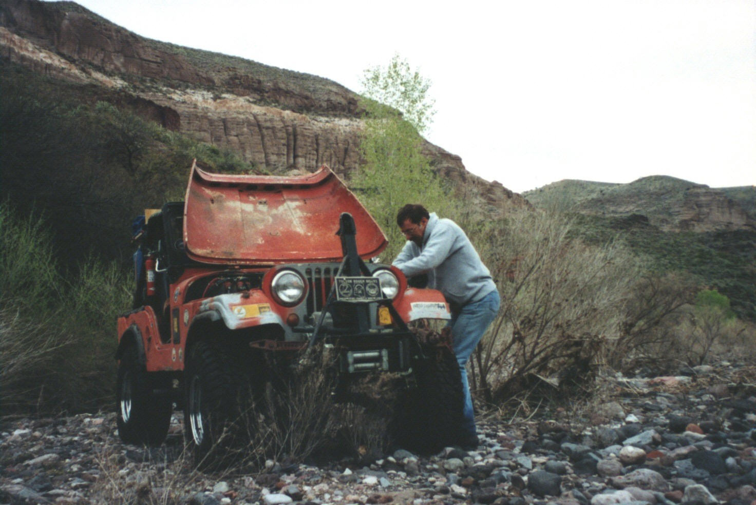
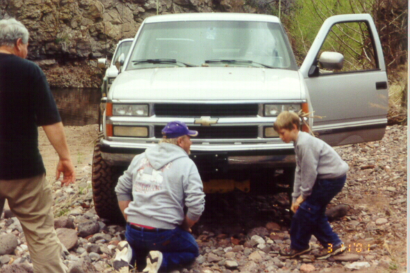
We left at 10AM after breakfast at Rebs Cafe in Benson. While gassing up and airing down in Morenci, John Hill found that he had a broken rear U-joint -- apparently residual damage from the Italian Trap run two weeks ago. A quick trip to the auto parts store provided the necessary replacement parts. We drove on down Eagle Creek a few miles, and John and John provided the lunchtime entertainment by changing the U-joint under the shade of a cottonwood tree. Everyone else had a great time watching us work.
We were not expecting any deep water crossings on this trip since Eagle Creek was only flowing at 18 CFS. However two alluvial debris flows from Guswedt Canyon and Trujillo Canyon have dammed Eagle Creek sometime in the last year. This has resulted in two places where you have to ford water which is nearly three feet deep. However, these seasoned veterans of the Gila Box, were hardly even phased by water "only" three feet deep. The cottonwood trees continue to make this trail down Eagle Creek more brushy every season since there hasn't been a big flood to cleanse the main channel since 1993. The challenge is often to find the trail through the maze of small trees.
Shortly after this, we saw a herd of ~35 bighorn sheep on the cliffs above the river. This was about 2 miles below the bat cave. The closest sheep were at a distance of 200 yards. There were several rams in the group with very impressive racks.
Later in the afternoon, Mike provided the first tow strap opportunity by getting his newly locked Jeep stuck in some slimy mud. (The locker only means that you get in deeper before you are stuck.)
Just about sunset, Ed managed to get the nose of his big Ford in a deep water hole that had been scoured out along a cliff. The water was over both headlights and part of the hood. Remember that the hood of even a stock F-250 sits pretty high. Just ask Jeff if you want to know how deep it was inside the truck, as he was on the low side. This provided the big winching opportunity of the trip. A big Chevy with a winch is just what you need to pull a big Ford up a sandy bank. The engine had swallowed a bit of water, but not enough to do serious damage. So after some draining and drying the air filter, we got Ed running again in the morning. Those who winched camped near this hole about a mile above the Gila. The others camped at the confluenced of Eagle Creek and the Gila River. We saw a handful of Leonids while sleeping under the beautiful dark sky overnight, but we were a few days too early for the big show.
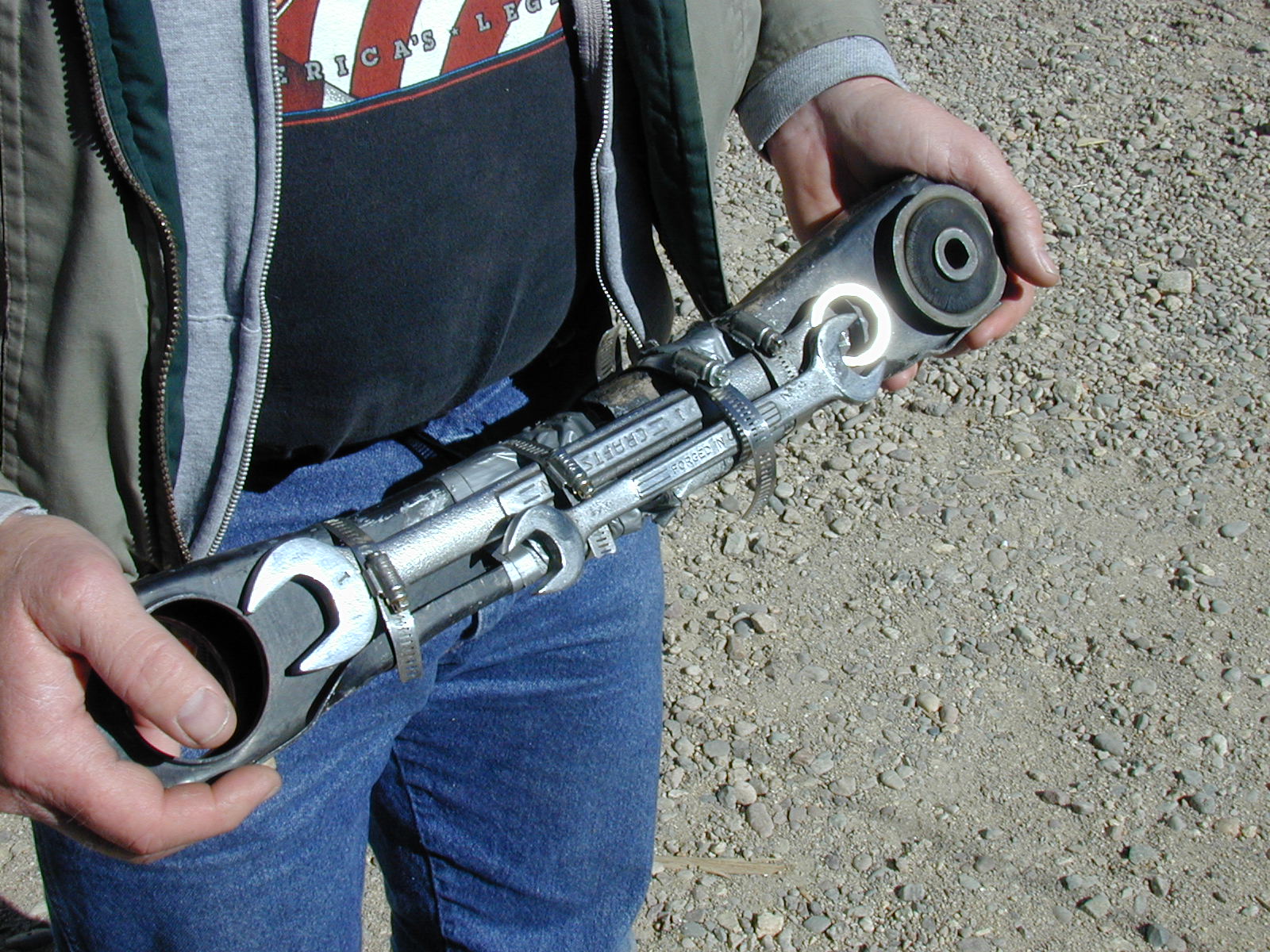
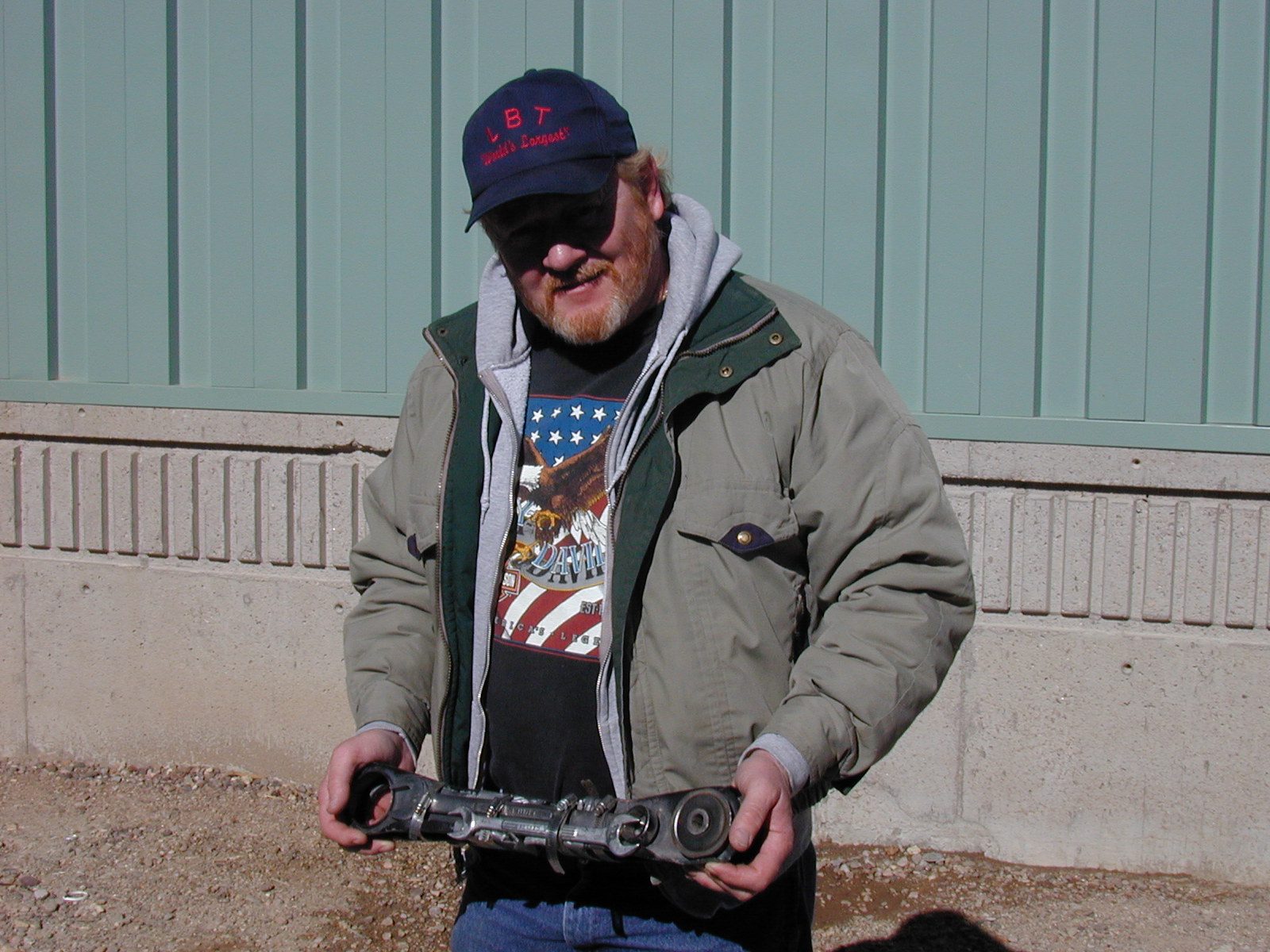
On Sunday morning, we went back up Eagle Creek and then exitted to the west via the graded trail that goes out through Guswedt Canyon to Turtle Mountain. This route is graded only in the roughest sense of the word. It is a very rough ride. The views back down into Eagle Creek are spectacular. Along the way, Mike Drake's lower front control arm broke. So on top of Turtle Mountain, we improvised a "splint" for the control arm with four hose clamps, 3 box end wrenches, 2 jack handles and a bit of duct tape. This held for the decent down into Bonita Creek. The baling wire was held in reserve for more serious breakage. "Dr. Waack" prescribes a lift kit with new control arms for the Jeep to be good as new.
The drive from Tucson to Morenci was a pleasant one with fields of wildflowers all along the way. However, by 11AM it was snowing in Morenci. Agreeing that we were ALL equally crazy, we set off for the pumping station in Eagle Creek. An hour later we were standing in the sun looking at two dozen Bighorn sheep high on the canyon wall above us! The good weather continued and we had mostly sunshine as we continued 10 miles down lower Eagle Creek on Saturday afternoon. The green of freshly sprouted cottonwood leaves left little doubt that spring had arrived. The participants were John "Over Easy" Waack in his Samurai, John Hill in his big Chevy "The River...Runs Through It", "Gonzo" Dave Peterson in his Jeep (without doors), and Bob "Free Willy" Peterson and Robbie "The Torch" Peterson in their full-size Blazer. Eagle Creek was running about 42 CFS on Saturday, so there was plenty of water crossing to be done. The upper portion of the trail is fairly well defined down to the Bat Cave. After that the crossings got progressive more rugged and brushy as we moved down stream. It appears that we were the first group of the season (since the early winter floods) to break the trail the whole way down to the confluence with the Gila River. The floods had definitely rearranged parts of the trail over the last 3 miles. All the vehicles were prepared for this kind of fun, so we had a great time. Although with "scattered showers" in the forecast, flooding was never far from our thoughts. We did one winching and one tow strapping. (While we didn't use the winches much, persons considering replicating this trip should note that we were carrying 5 winches in the 4 trucks, and had food for 3 days with us.) The temperature was cool enough to make the roaring mesquite fire on the banks of the Gila River quite enjoyable. However, the same fire was also quite thrilling because the fire ring was made of the infamous Eagle Creek exploding rocks. Numerous explosions punctuated the evening launching fragments of red hot rock into the air. One blast launched a handful of mesquite coals which burned through the seat of Dave's camp chair (10 feet from the fire). Fortunately Dave was not occupying the chair at the time. Robbie discovered that the exploding rocks are some kind of copper ore by noticing that you can see metallic copper in the fragments. We had some light rain showers overnight. By mid-morning Sunday was very cloudy and gloomy, but we still had a great time wheelin' back up Eagle Creek. Climbing the sand and gravel bars provided just the right kind of challenge for all the vehicles. The water level had risen slighly overnight to 60 CFS. We wound up making about 6 crossings in 30-inches of water, and 1 crossing in 38-inches of water (each way). We saw 7 more Bighorns on Sunday. The only vehicle damage was a broken fan belt on the Jeep. Everybody got their pinstriping freshly burnished. We were back in Tucson by 5PM.
Total Highway miles: ~320
Total Off-Highway miles: ~24

.
.
.

.
.
.
.
.

.
.
.
.
.

.

.

.
.
.
.

.
.
.
.
.
.
.
.
.
.
.

.
.
.
.


The first few miles downstream from the trailhead at the pumping station are easy going, but the going gets rougher as you approach the Gila. In the dry season, the trail rating going downstream is 2.5 at the start increasing to 3.5 as you near the Gila. Add half a point for coming back upstream climbing the sandbanks. Sand along Eagle Creek ranges from fine silt to volleyball-sized particles. The ride is quite rough on the lower section. Stock 4x4s can make the trip, but wide tires and low air pressure are extremely useful.
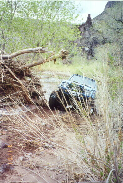
The lower sections of Eagle Creek are becoming quite brushy as the time since the 1993 floods increases. The stands of cottonwood, willow and tamarisk growing in the streambed are becoming progressively thicker and taller. They will give the Arizona pinstriping on your truck a nice burnishing.
See the 2006 trip reports for a description of the trail since the January 2005 floods.
See the July 1999 BLM Press Release which indicates that Eagle Creek has been included in the Gila Box Riparian National Conservation Area via a land swap with Phelps Dodge.
| Landmark | UTM Easting | UTM Northing | Altitude |
| Clifton (Hwy 191 @ San Francisco River) | 12 6 59 200 E | 36 57 900 N | +3480 |
| Morenci (X Hwy 191) | 12 6 56 720 E | 36 58 200 N | +4030 |
| Eagle Creek Road turnoff (@ Hwy 191) | 12 6 52 000 E | 36 60 100 N | +5130 |
| Phelps Dodge Pumping Station | 12 6 45 750 E | 36 58 600 N | +3630 |
| Guswedt Canyon at Eagle Creek | 12 6 46 900 E | 36 56 150 N | +3515 |
| Bat Cave | 12 6 48 500 E | 36 54 800 N | +3600 |
| Eagle Creek at the Gila River | 12 6 49 000 E | 36 47 800 N | +3300 |
| Turtle Mountain/West | 12 6 41 300 E | 36 51 300 N | +5915 |
| Bonita Creek at the Gila River | 12 6 42 400 E | 36 40 300 N | +3170 |
| San Francisco River at the Gila River | 12 6 52 150 E | 36 46 700 N | +3500 |
| Safford (Hwy 70 & Hwy 191) | 12 6 21 000 E | 36 33 480 N | +2915 |
| Solomon (Hwy 70 & Sanchez Road) | 12 6 28 240 E | 36 31 600 N | +2969 |
Last modified: Mon May 25 21:20:09 2009