Trip Report for our Colorado/Utah Wheelin' Trip 22-27 September 2006.
From hill Wed Oct 4 19:22:11 2006
Participants were Bob P. in his fullsize Blazer, Rick M. and Jerry P.
in Rick's 4Runner, Ed McC and John S. in Ed's F-250, Mike DiM. and Ron
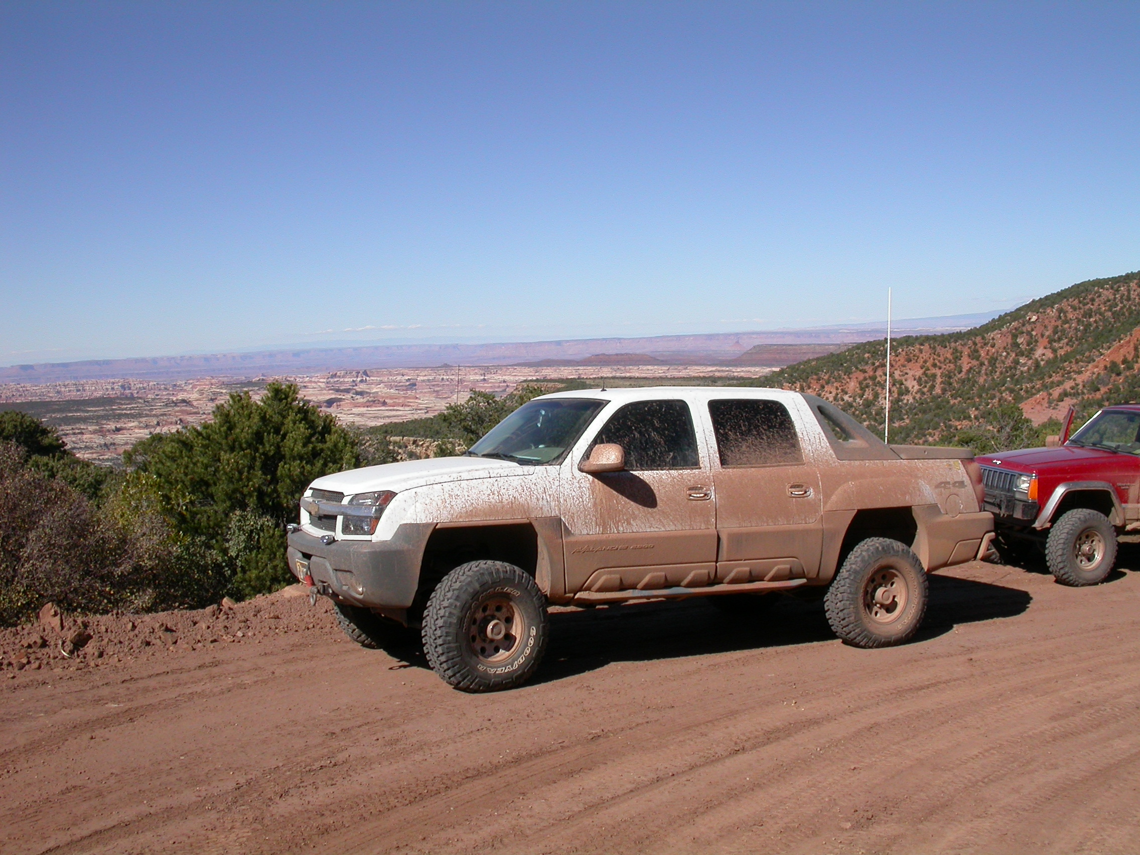
P. in Mike's Cherokee, and John H. and Jon R. in John's Avalanche 2500.
Between these 5 trucks we have 9 locking differentials and 4 winches,
so very few roads can stop us. And it is very comforting to have
3 professional auto mechanics along on the trip.
Plan "A" was to run the high passes in the San Juans between
Telluride/Ouray/LakeCity/etc. Plan A was quickly defeated by snow in
the mountains the day before we left. Even the well equipped 4x4
can't handle multiple feet of snow on the passes above 12000 feet.
Plan "B" was to run the lower passes (below 11000 feet): Scotch
Creek/Roaring Fork near Rico, Last Dollar near Telluride and Owl Creek
near Ridgway.
We drove from Tucson to Cortez on Friday 22nd.
Saturday, September 23
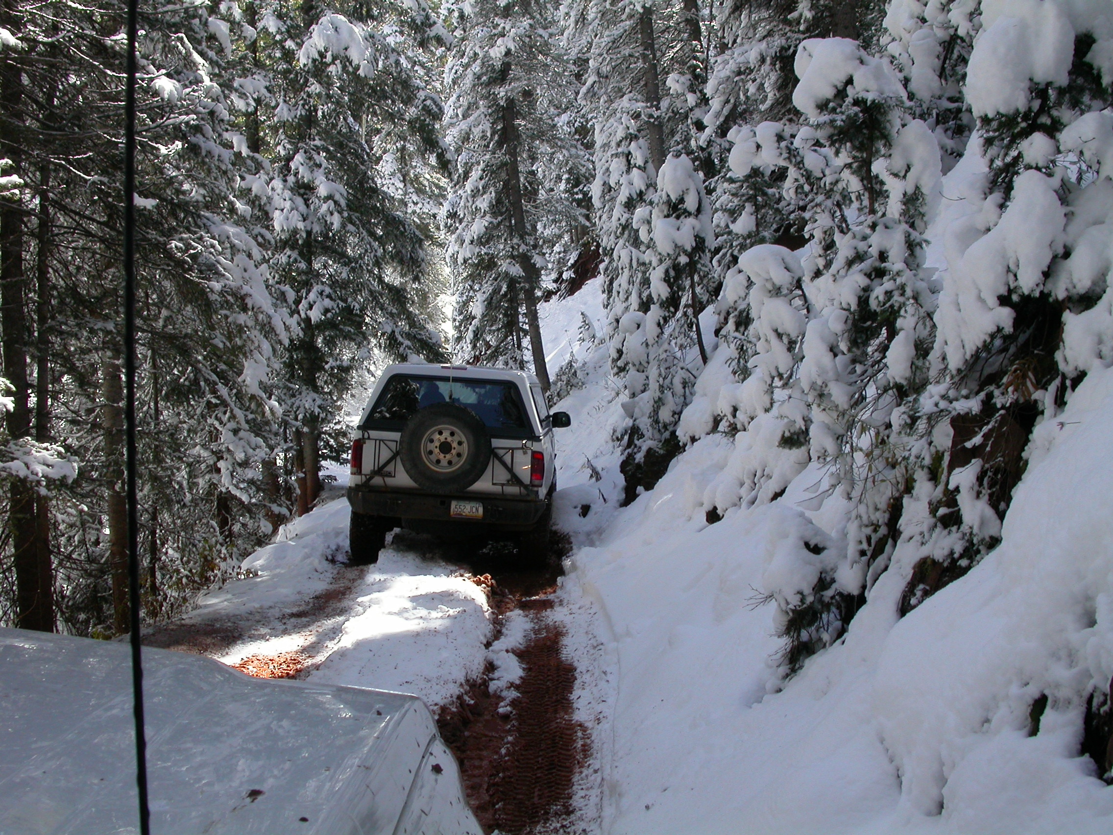
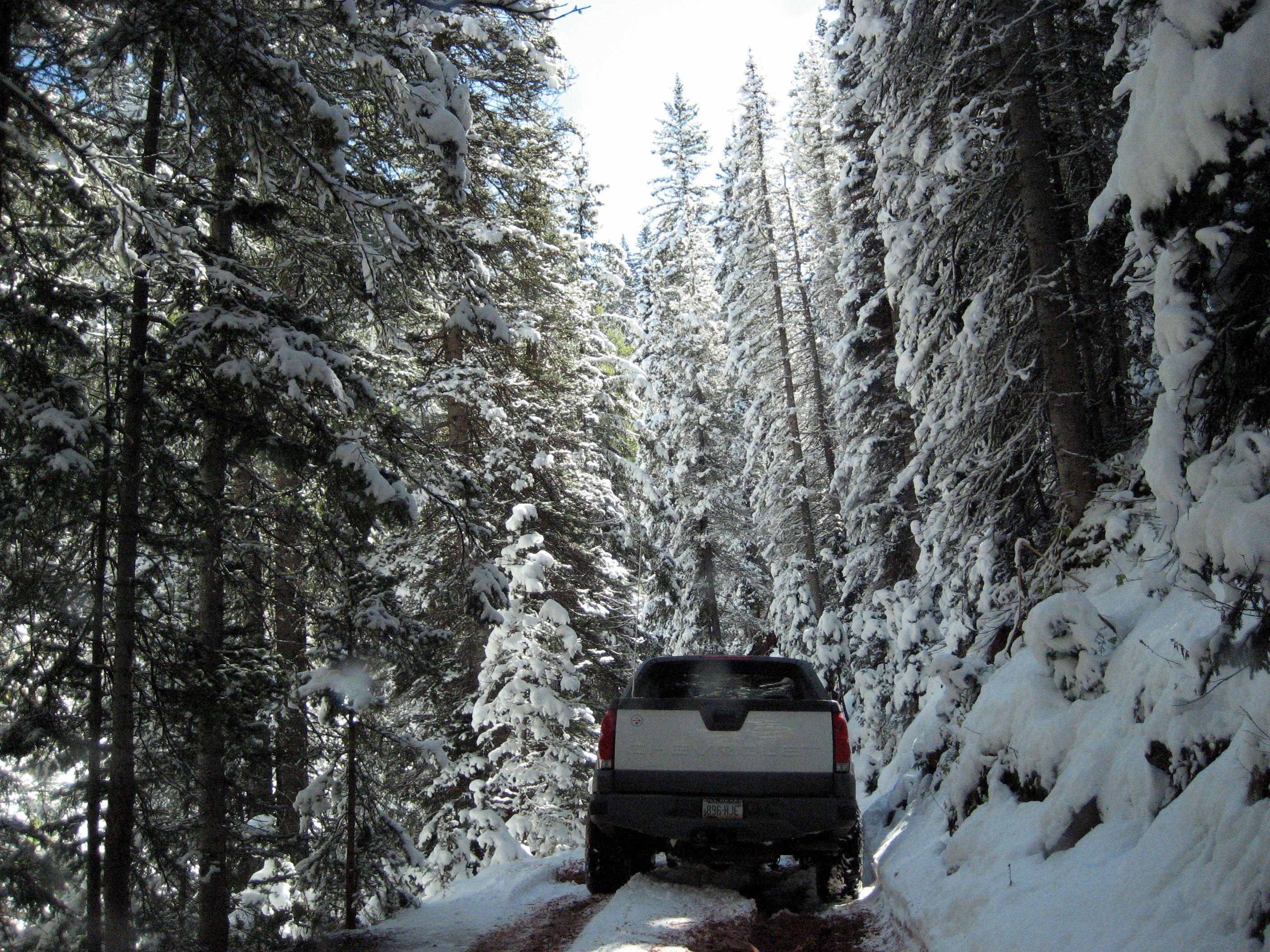
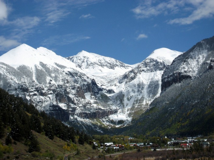
We had breakfast in Dolores on Saturday morning. Then we ran up
Scotch Creek and came down Roaring Fork near Rico. The snow level was
at 9000 feet, so we were running in 6-inches of snow above 10000 feet.
The snow was fun on level ground, but got pretty greasy on some
off-camber sections. This easy trail in dry weather provided plenty
of wheelin' challenge and pucker factor. The sun was out and the
scenery was unbelievable with snow-capped peaks and snow-covered aspen
trees.
Photos by John H.
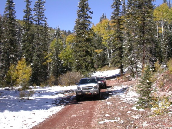
On the trail going up Scotch Creek.

The snow is getting snowier.
Fantastic views in the high meadows.
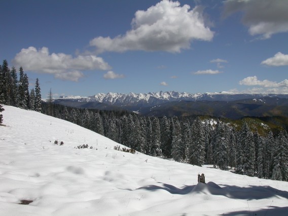
Photos by Ron P.

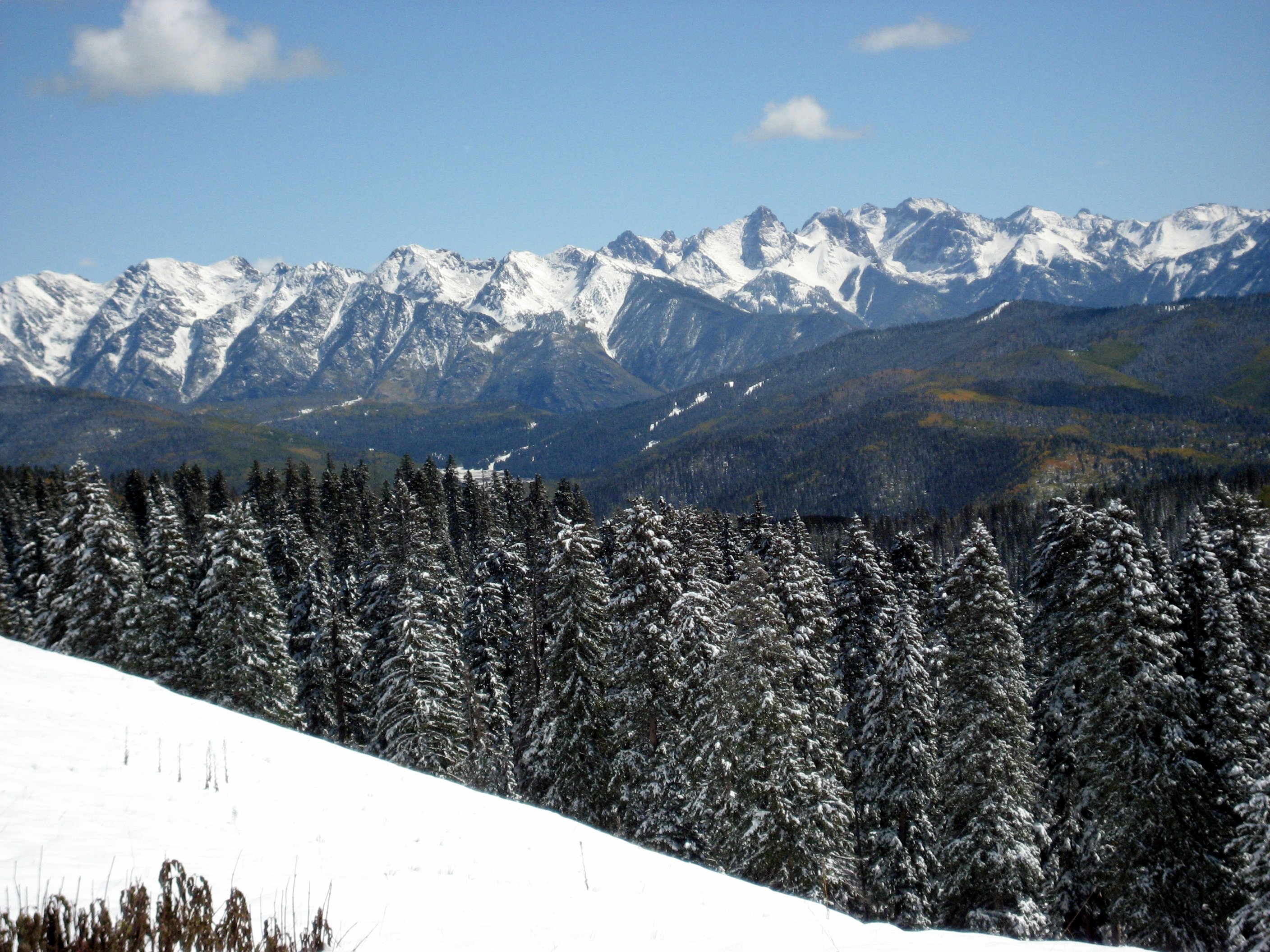
Upper part of the Scotch Creek trail.
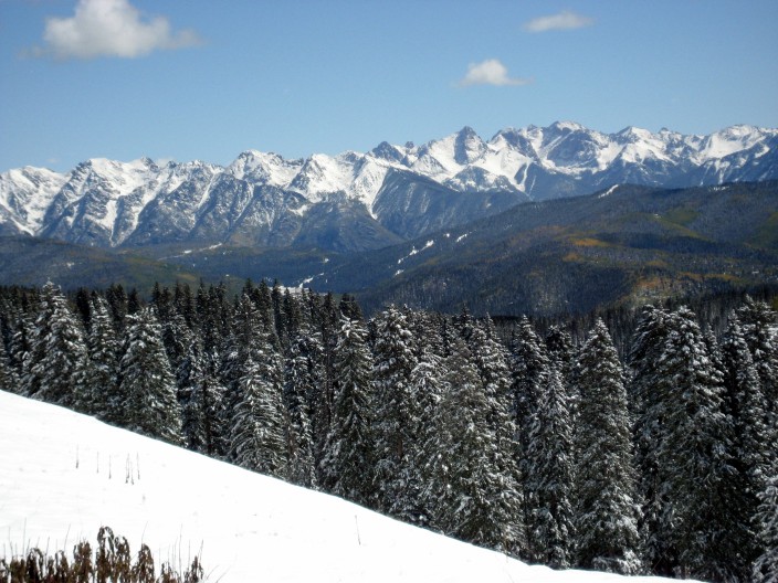
Spectacular view from the meadows at 11000 feet.
Looking up the valley toward Telluride.
More photos from 23 September
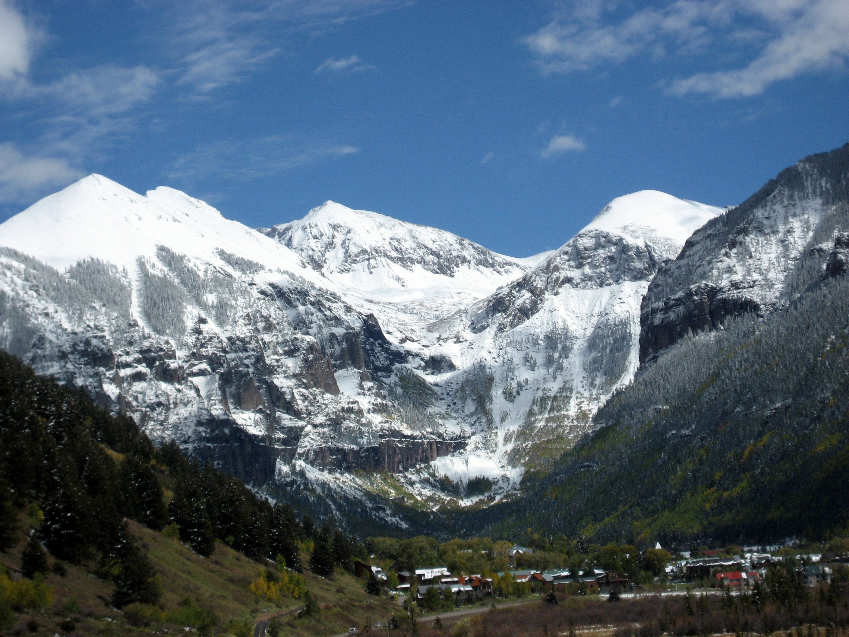
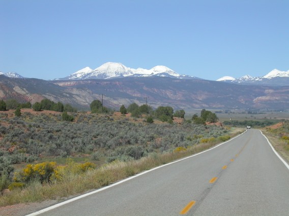
Our next thought was to run Last Dollar Pass between Telluride and
Ouray, but as we drove north we found the snow level dropping down to
7000 feet. We wound up taking the highway via Ridgway to spend the
night in Ouray. Chicken-fried steak and green-chile burgers at
Maggie's Kitchen in Ouray were fantastic. Rick and Jerry were intrepid
enough to camp at the state park near Ridgway while the rest of
us enjoyed the Twin Peaks Best Western in Ouray.
Sunday, September 24
A look at still frozen Owl Creek Pass from a distance on Sunday
morning convinced us that Plan "C" was in order. So we drove over to
the Needles area of southern Utah. Snow on the San Juans and the
LaSals gave even this highway drive some impressive scenery. After
topping off on gas in Monticello, we took N Creek Road to the west
over the mountains and through the forest to Jackson Spring Road
toward Needles. This road turned out to be a 2-lane paved highway the
whole way, so it was faster than going on the main highway. After
rejoining Hwy 211 we turned south on Beef Basin Road and headed south
into Manti-LaSal Forest. We turned south on North Elk Ridge and then
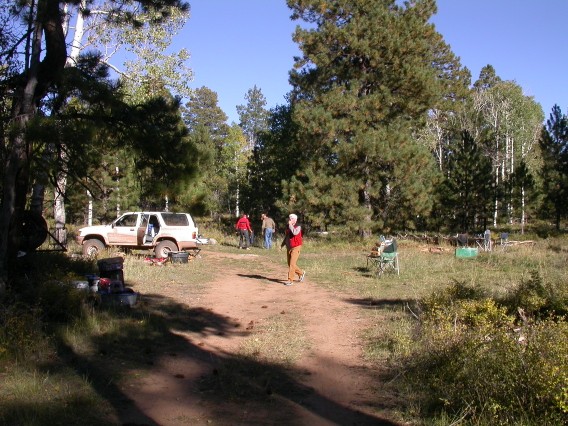
West on Gooseberry Road. We camped at 8500 in the pine forest between
Big Notch and Little Notch. The weather was clear and cool getting
down to about 30 degF overnight.
Photos by John H.
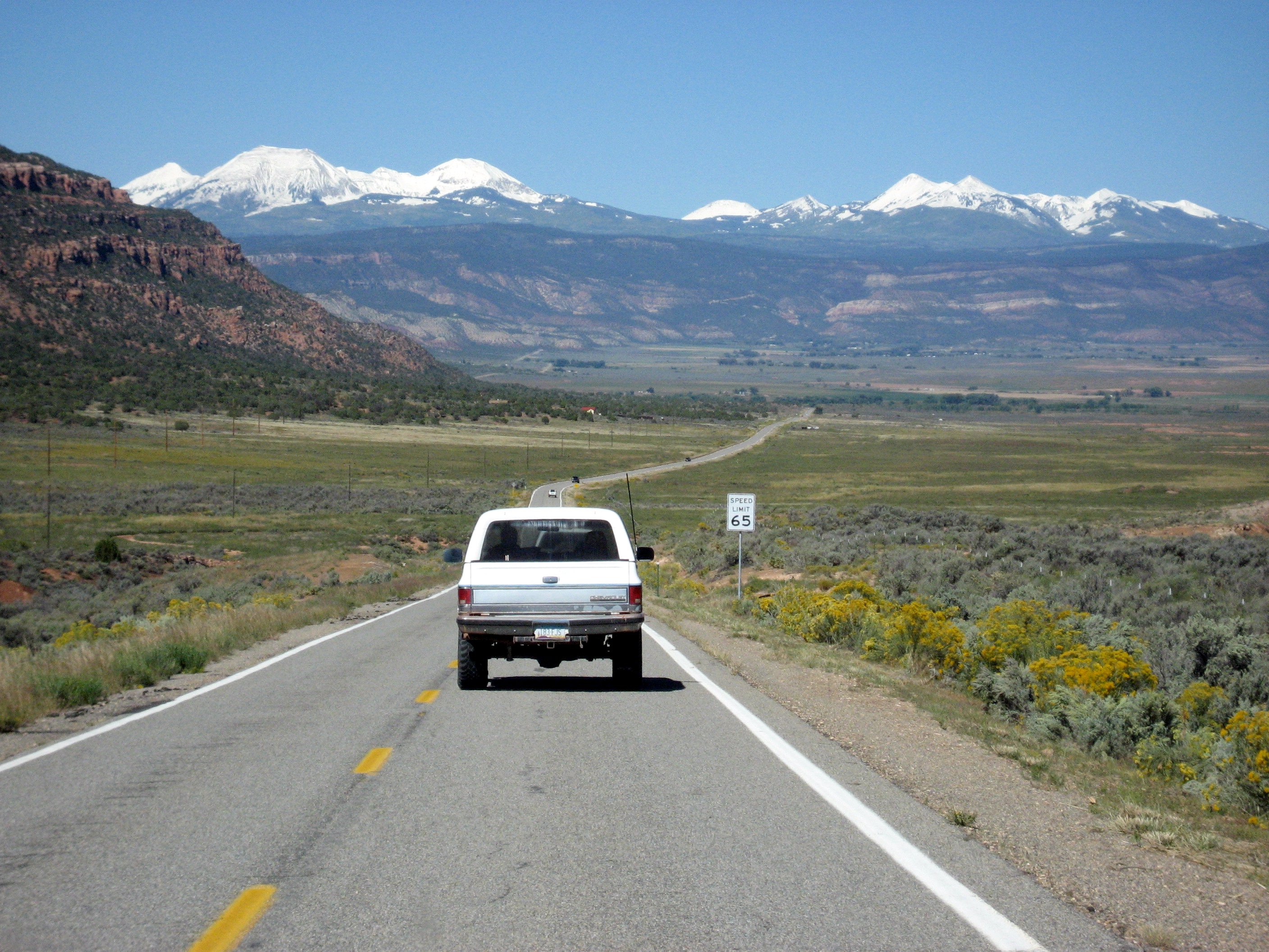
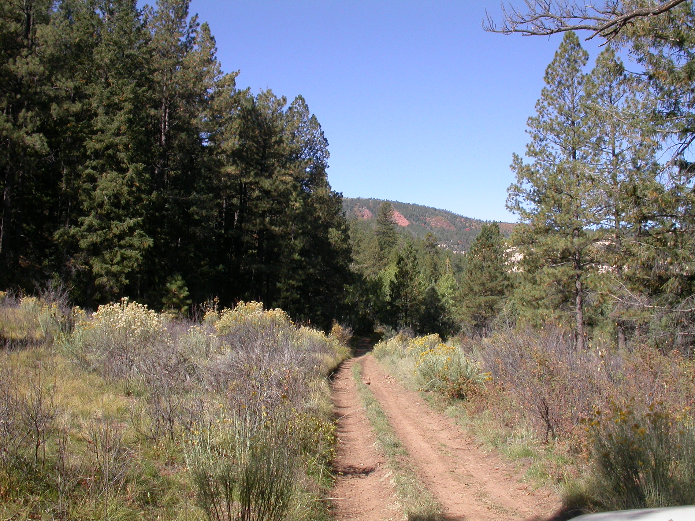
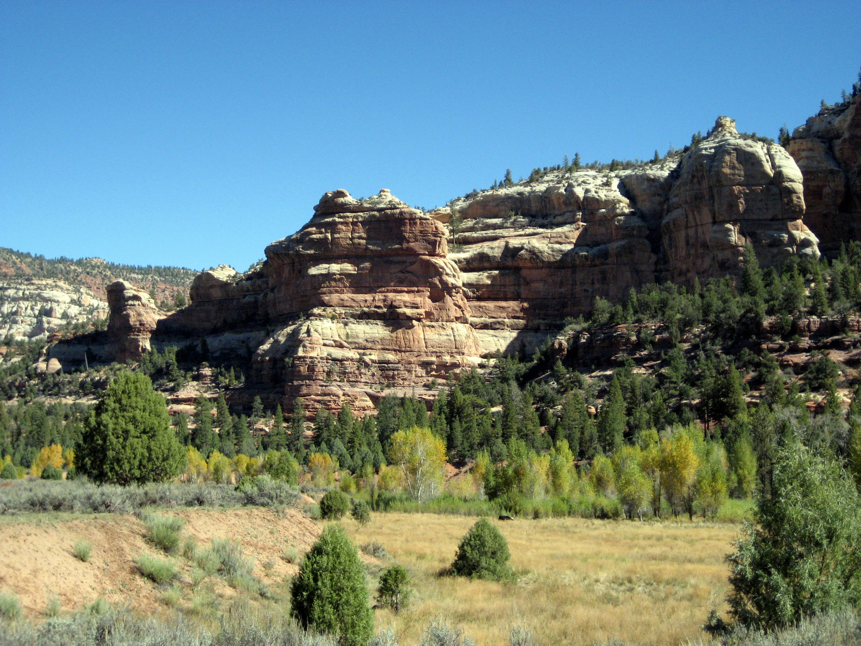
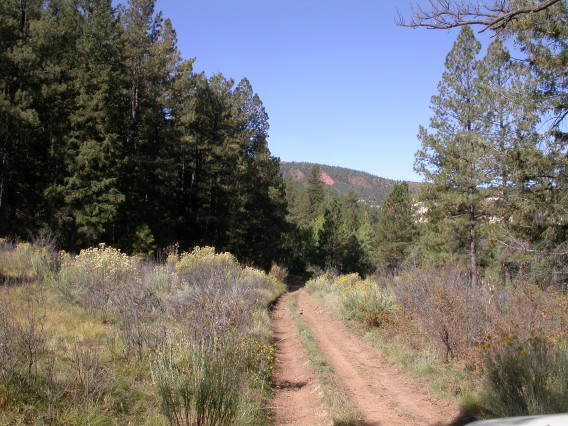
On the road toward Utah.
Along Beef Basin Road.
Camping along Gooseberry Road.
Photos by Ron P.

On the road toward Utah.

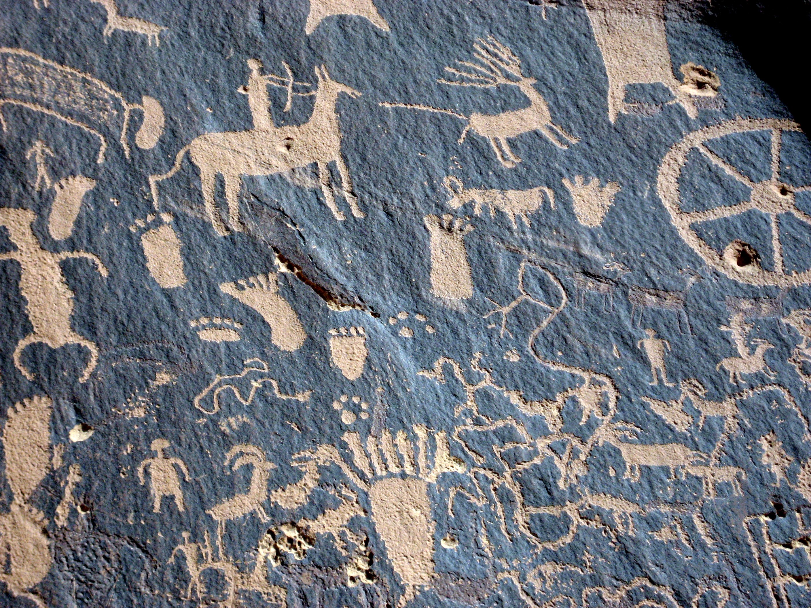
Newspaper Rock.
More photos from 24 September
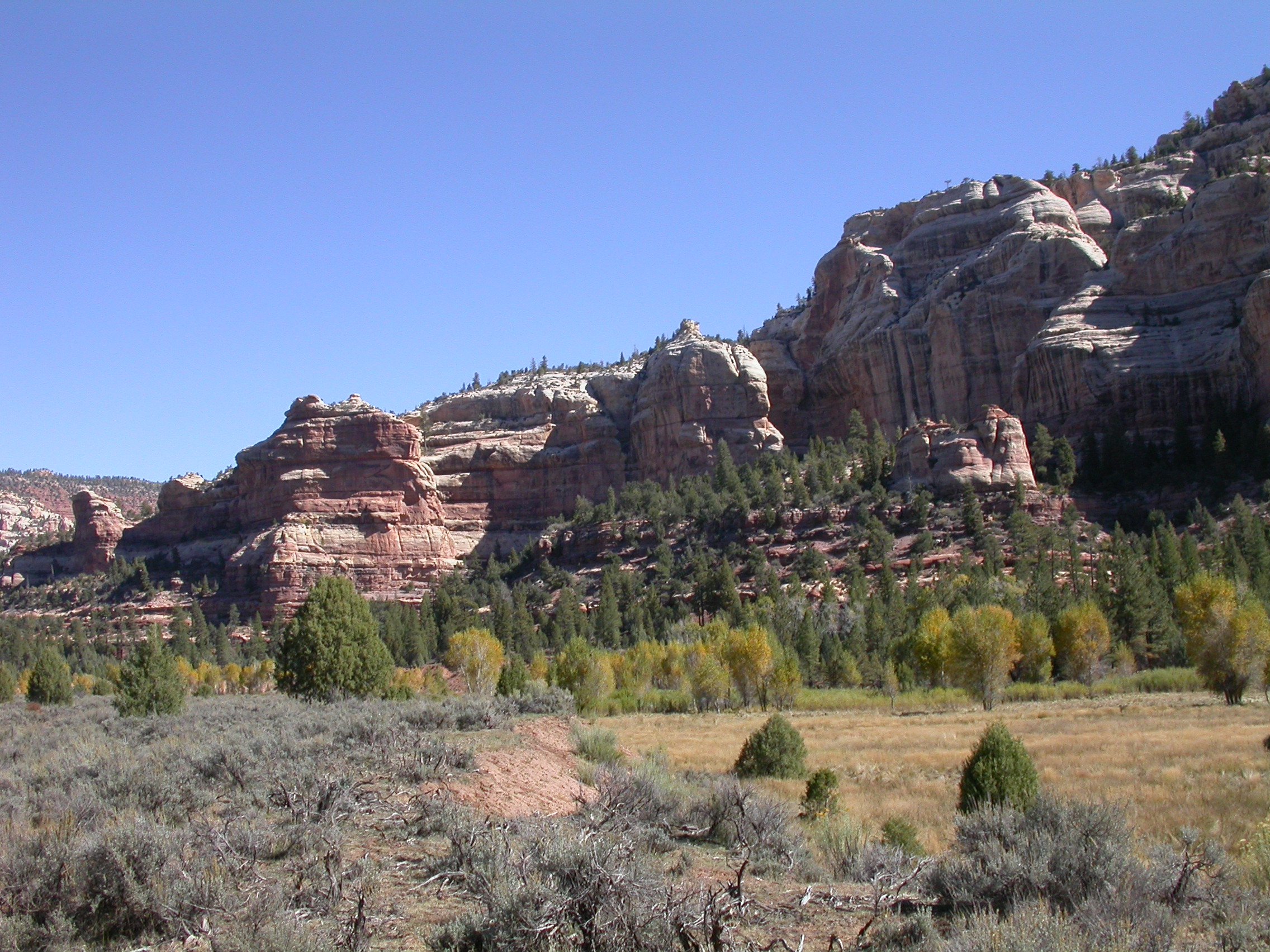
Monday, September 25
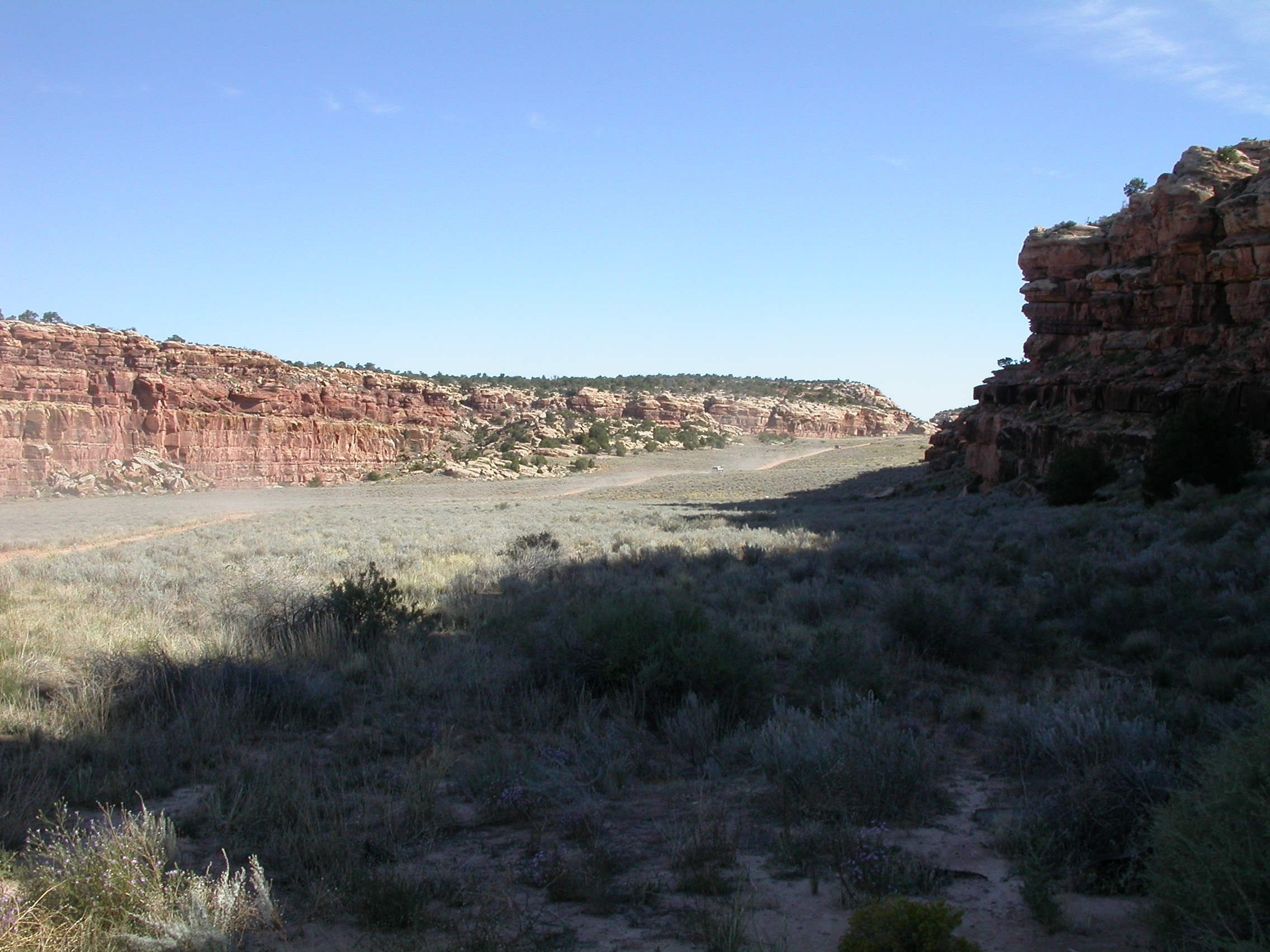
On Monday we followed the "Peavine Corridor" down into Peavine Canyon
and Dark Canyon. This is a narrow corridor for vehicle access into
the Dark Canyon Wilderness. The scenery was incredible. The surprise
to me was that even after driving down into the canyon, you are still
in a pine forest -- even at the bottom of the canyon. The trip is
very accurately described in Tony Huegel's book "Utah Byways: ....".
The trail down into the canyon was slightly graded so that even stock
4WD vehicles could make it (Trail rating 3, 4WD required). However,
it is narrow and winding so that inexperienced drivers or those afraid
of heights should not try it. Down in the bottom of Peavine Canyon,
the trail becomes progressively more challenging as it crosses a
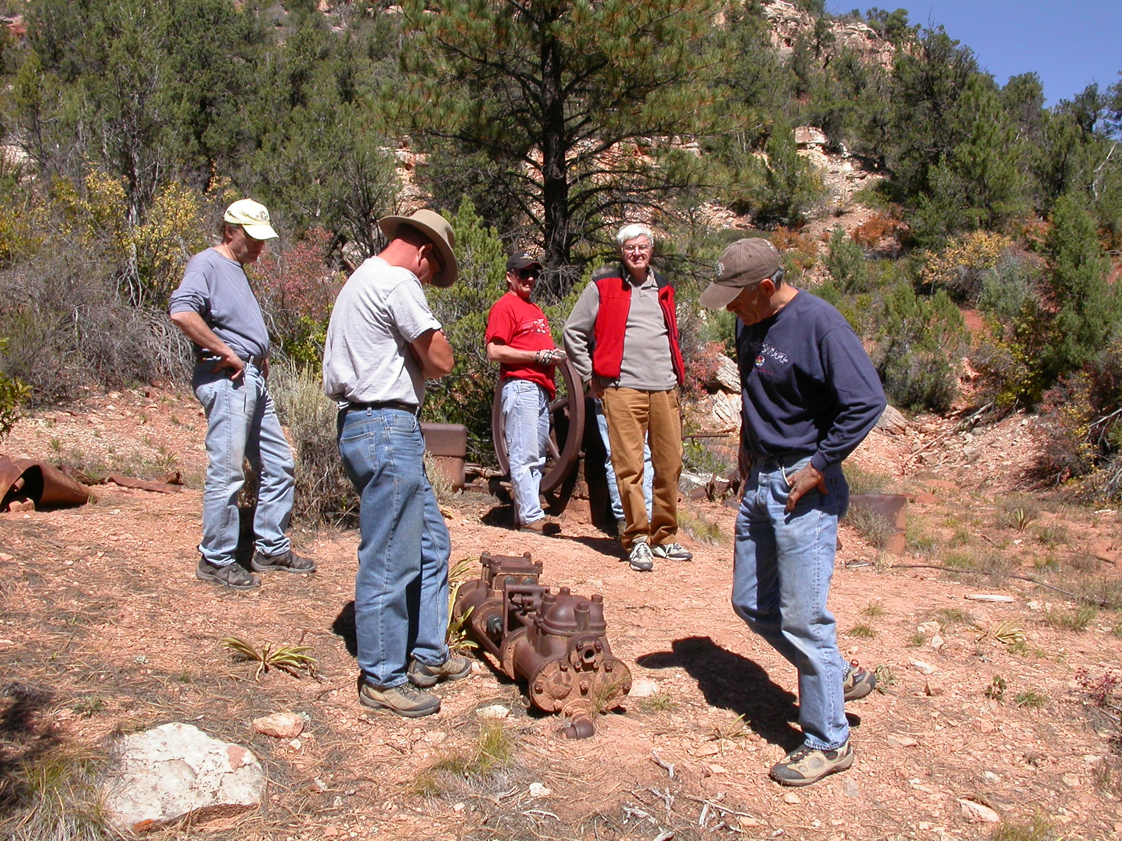
number of narrow sandy washes in the canyon bottom. We took the right
fork to see the old oil well in Rigg Canyon. That trail is rougher
(rating 3.5) with a couple rock steps to climb and lots of brush. We
had lunch near the old 1920's oil well. I thought we were going to
have to spend the night since the mechanics and technoids (all 9 of
us) were having such a good time looking at the well equipment. Next
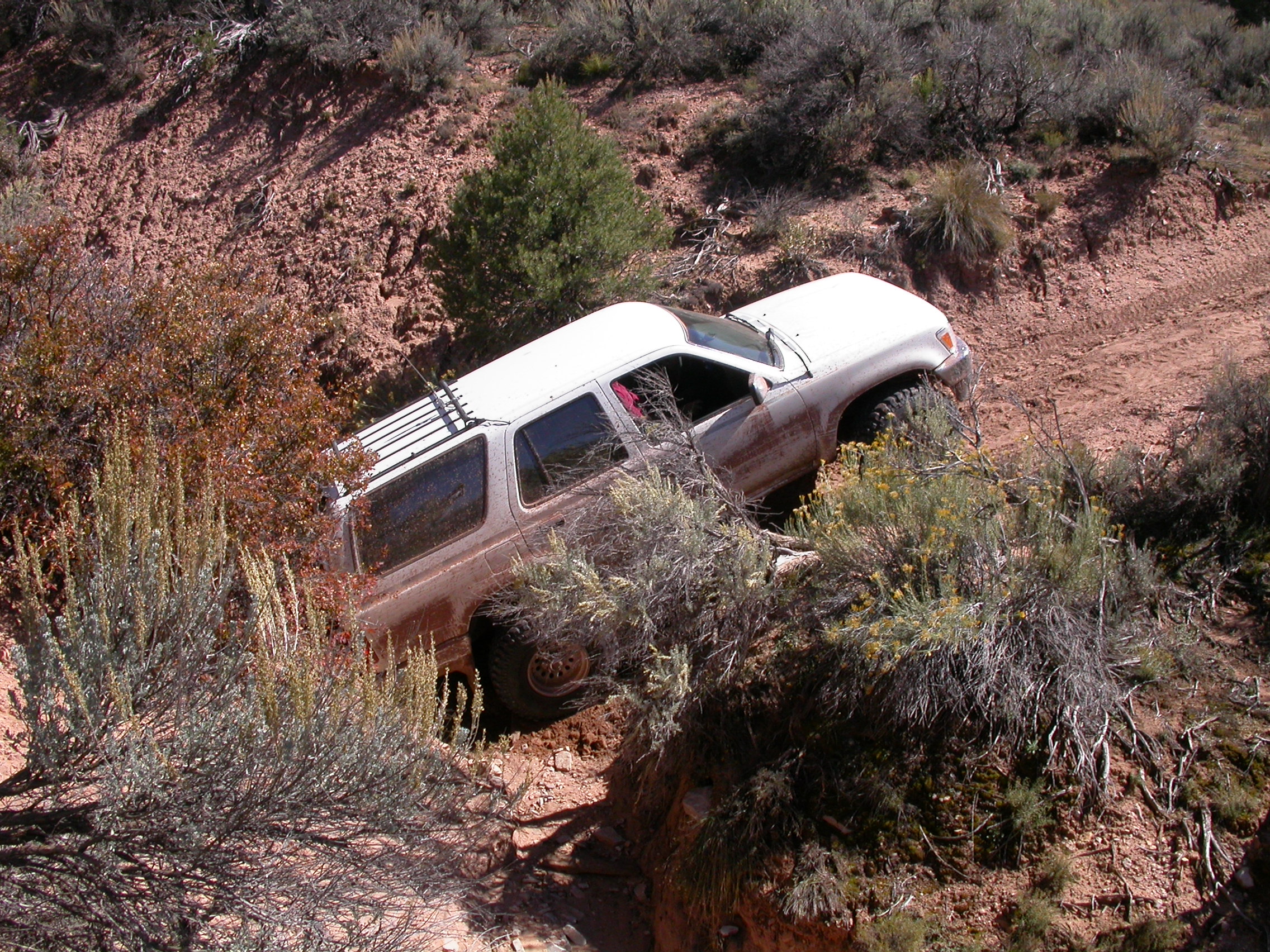
we took the left fork toward the old cabins. This trail was really
challenging (rating=4) because now the sandy washes we had to cross
were V-shaped and 10-feet deep. The tow strap was needed to help the
long wheelbase vehicles across -- at least until enough bumper
scraping smoothed out the bottom. After the wash crossing, we got
bogged down in a place with silty mud. The Cherokee would float on
top, but the 3/4-ton vehicles sunk in about 6-inches in slimy mud. We
required some winch action to escape (we wouldn't have gone in without
winches and lockers). Remember that it wasn't really a wheelin' trip
unless you used the winch. A couple people hiked up 1/3-mile to see
the cabins, but most of us turned around at/in the mud.
Photos by John H.
The road in the bottom of Dark Canyon.

Farther down in Dark Canyon.

Checking out the oil well equipment in Rigg Canyon.

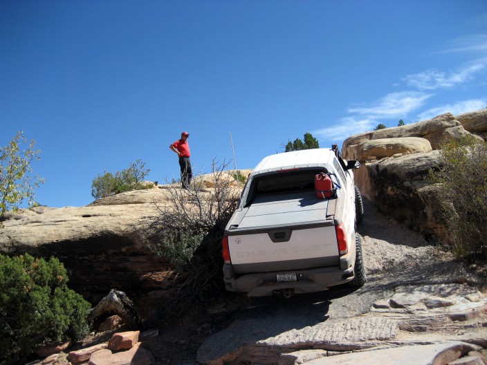
Crossing deep sandy washouts.
Photos by Ron P.

Never try to figure out the sign that was laying on the ground......

In the bottom of Dark Canyon.
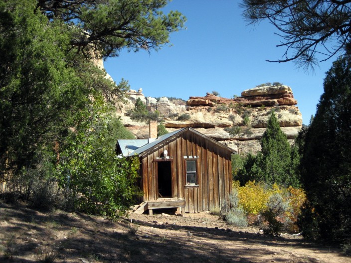
The cabins.
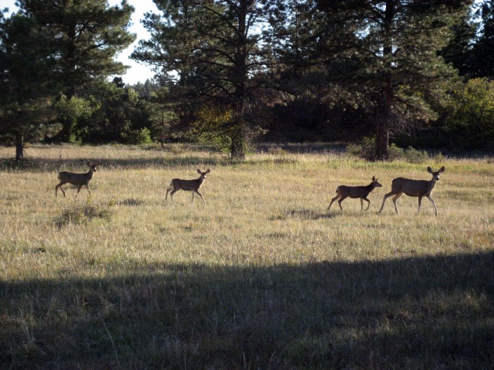
Plenty of mule deer here.
More photos from 25 September
We came back out of Dark Canyon, and camped in the same scenic spot in
the forest on Monday night. This place isn't called Elk Ridge for
nothing. The elk bugling was almost enough to keep you awake at
night. We also saw remarkable numbers of mule deer and wild turkeys.
Monday might was warmer, but we still enjoyed the roaring campfire.
Tuesday, September 26
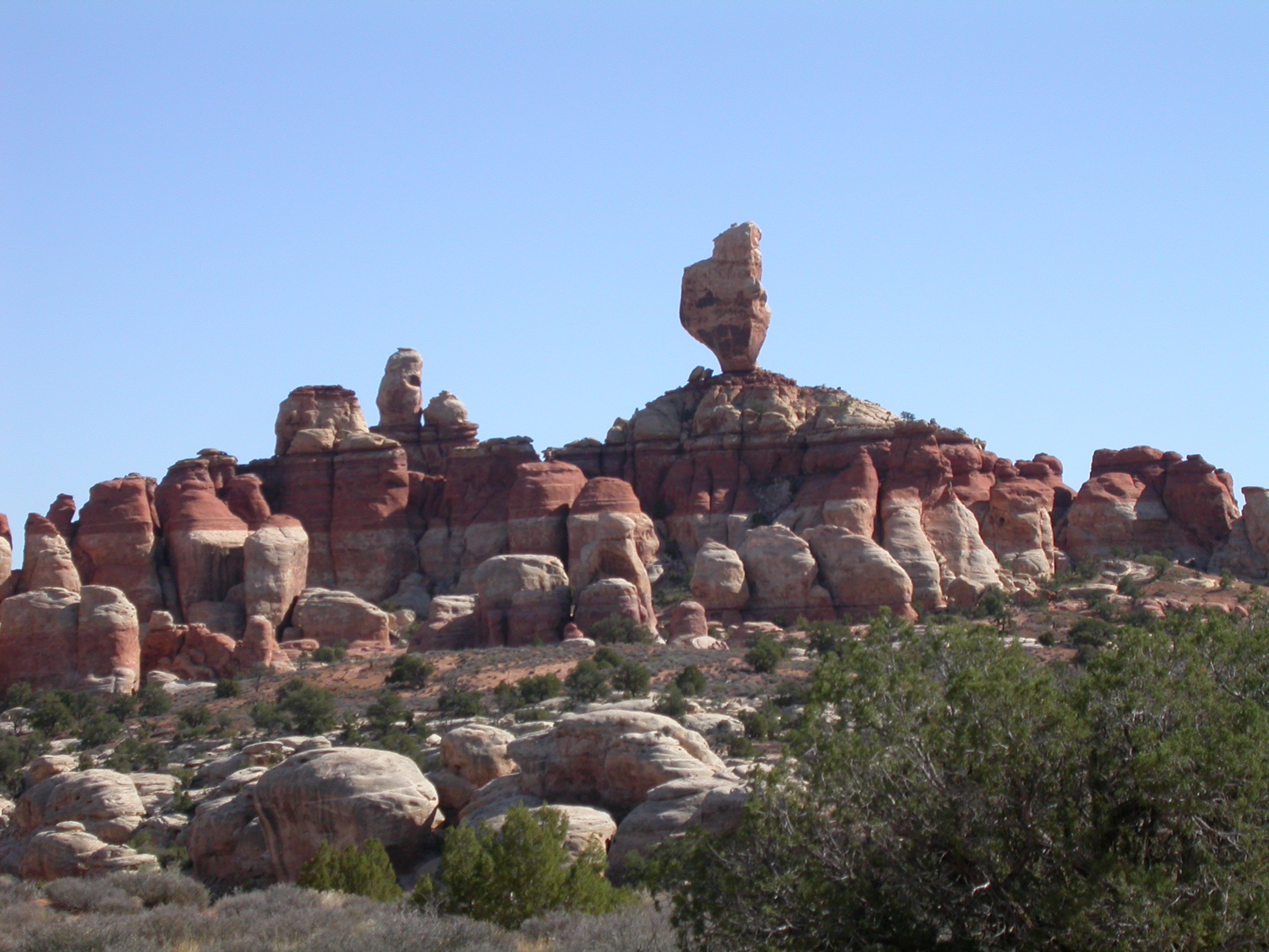
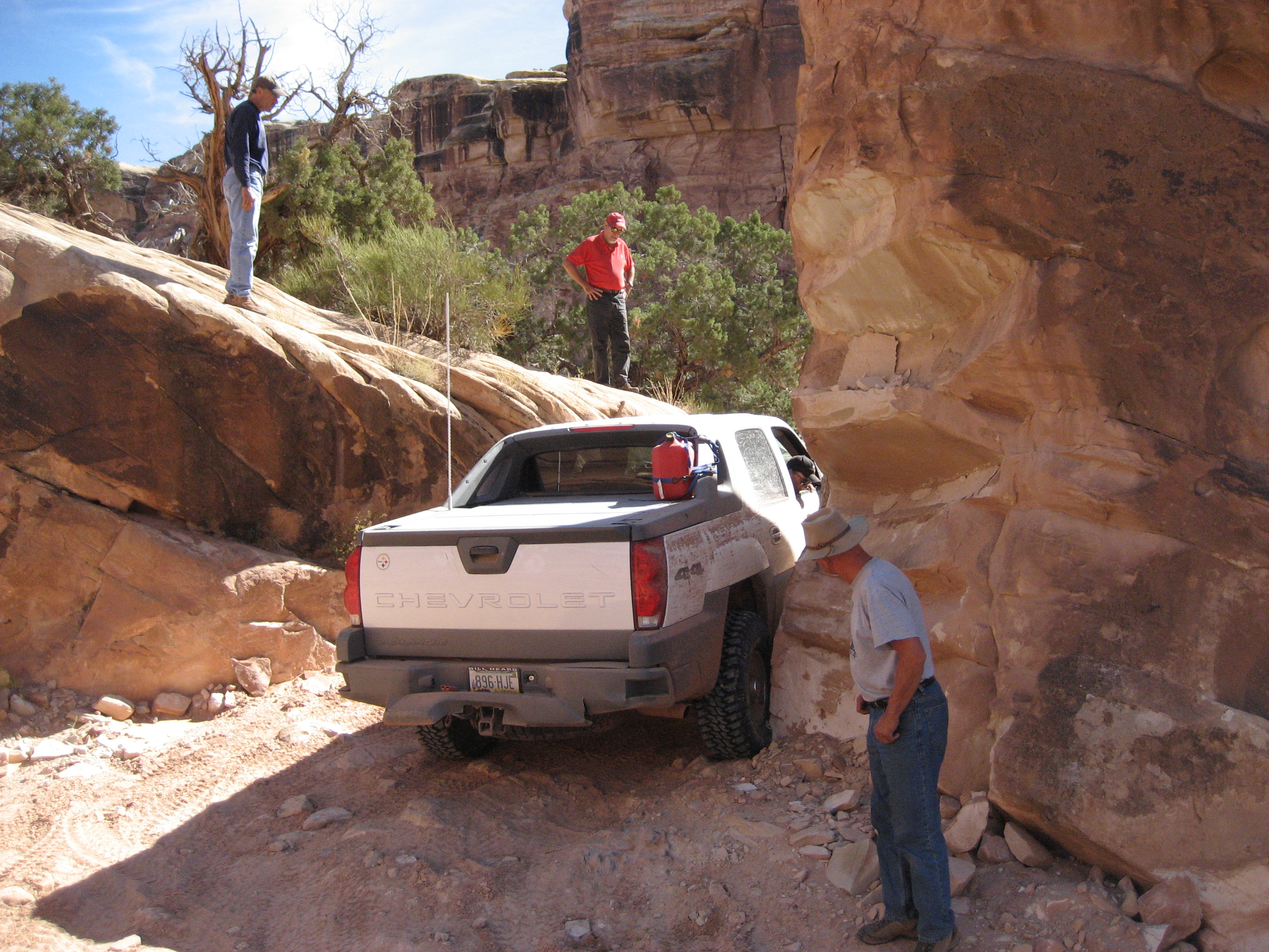
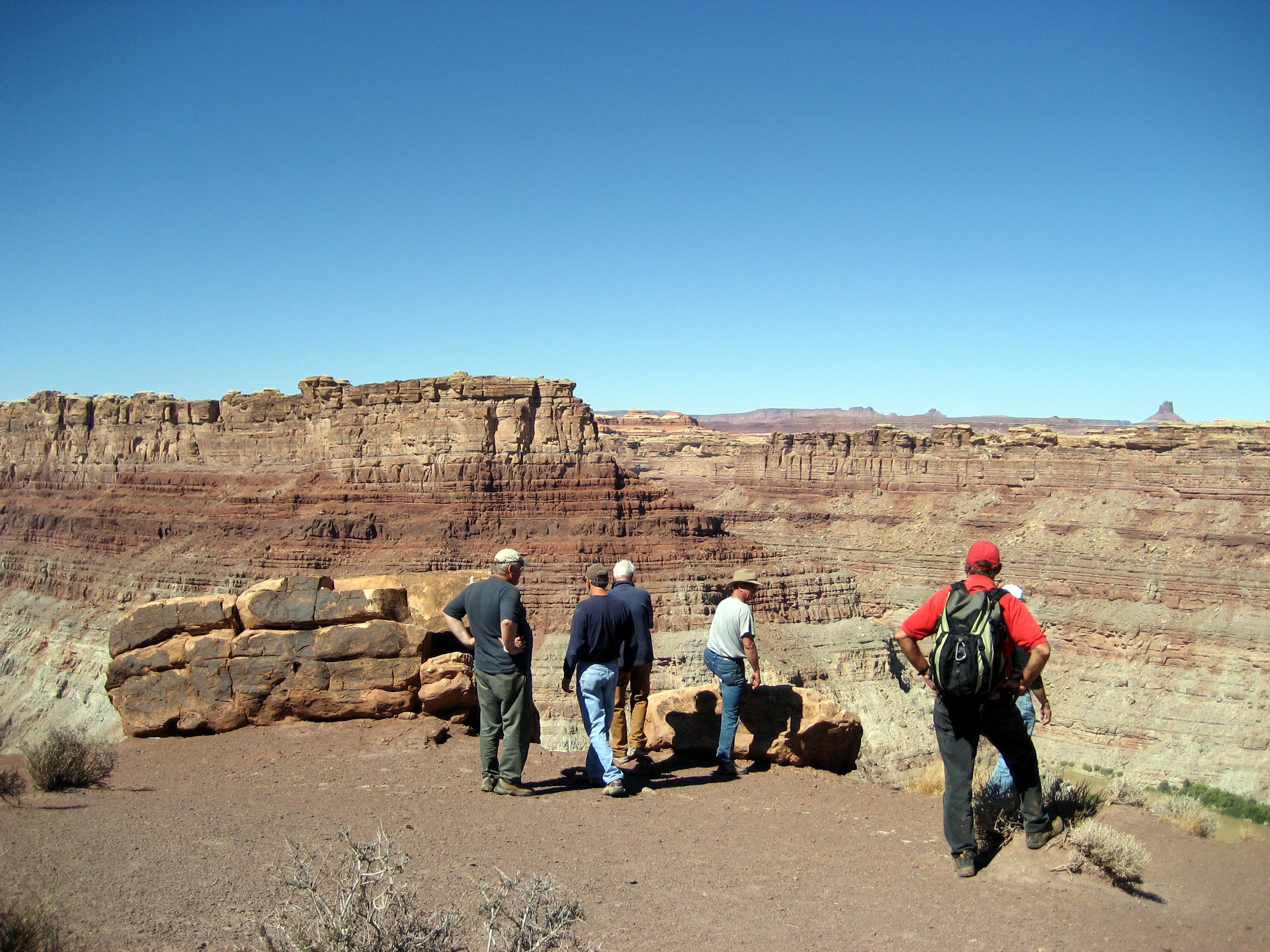
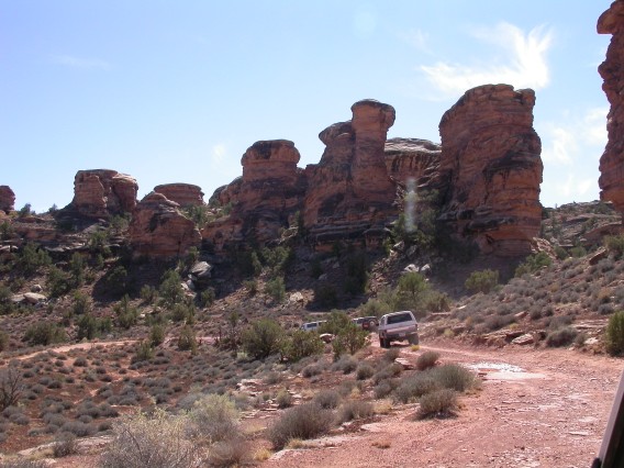
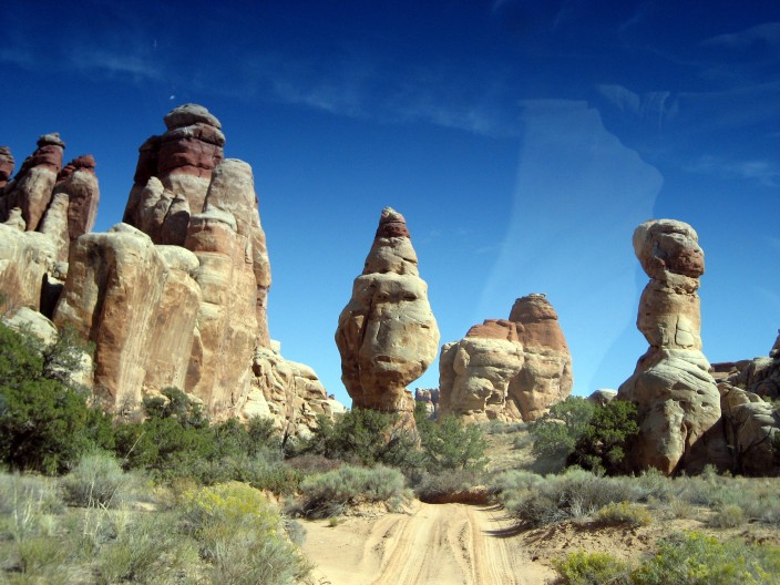
On Tuesday morning we went back to Beef Basin and went in the south
entrance of the Needles District of Canyonlands National Park (past
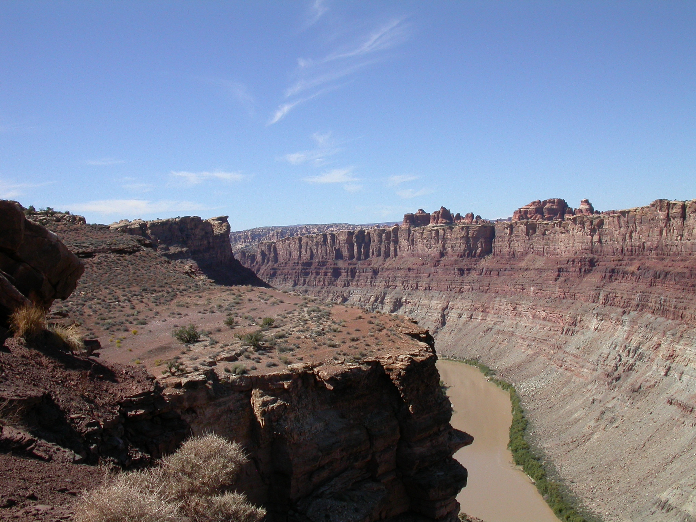
Bobby's Hole). We took the road in Needles out to the overlook of the
confluence of the Green River and the Colorado River. We hiked out to
the overlook at lunchtime Then we came back out of Needles via
Elephant Hill. These roads are rough enough to be fun (rating=3), and
the scenery is incredible (did I say that before?), but there isn't
much chance of damage on these well equipped vehicles. A signifcant
entertain/frustration was listening to some lady on the CB
spectulating about how our fullsize trucks weren't going to make it up
Elephant Hill. Too bad she didn't get to see that we hardly slowed
down on the way up!
Photos by John H.

Coming into the south (backdoor) entrance of Needles.
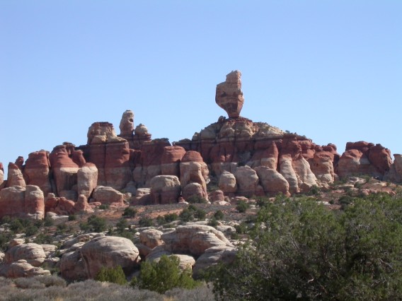
Formations in the Needles District of Canyonlands National Park.
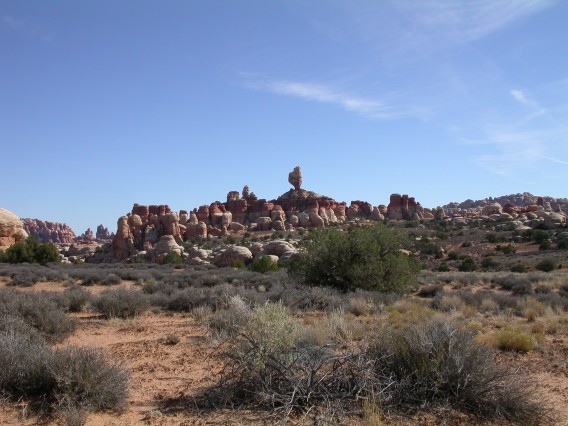
Formations in the Needles District of Canyonlands National Park.
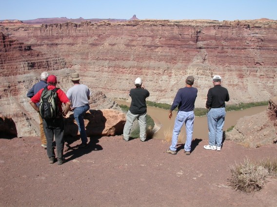
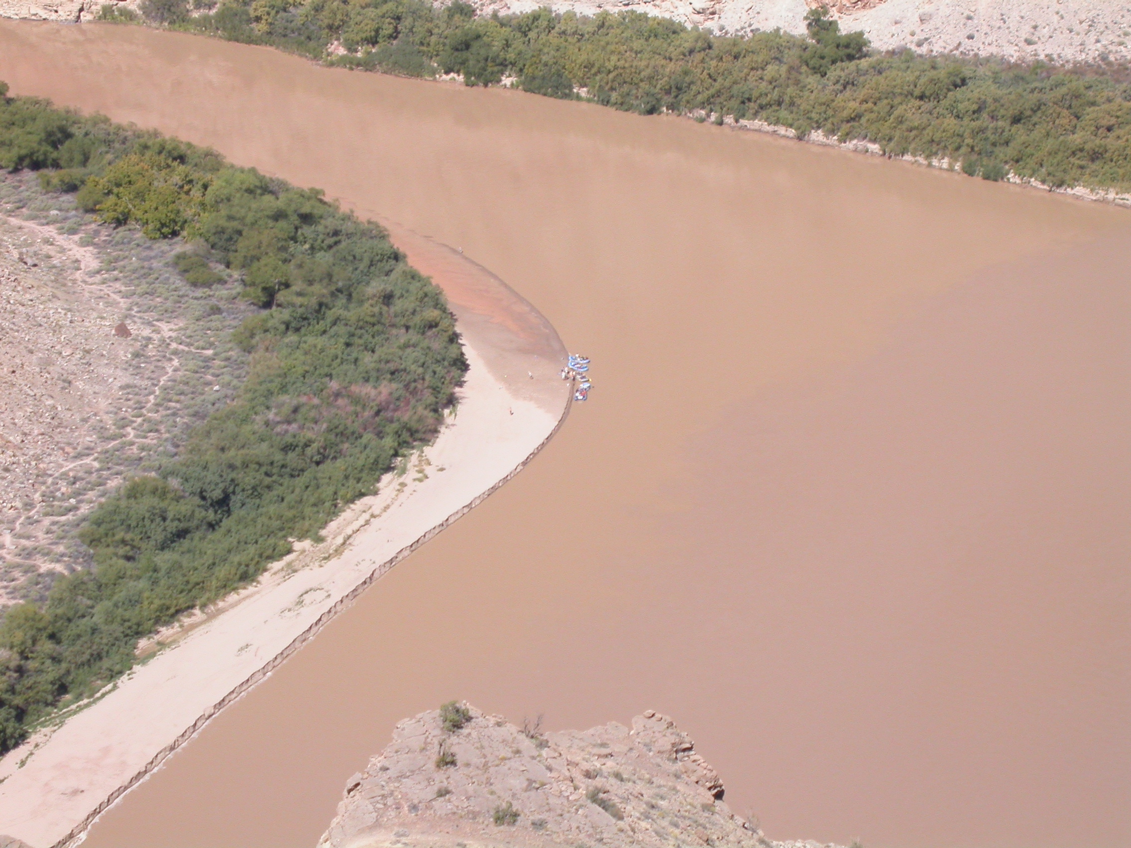
Overlook of the confluence of the Green River and the Colorado River.
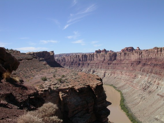
Looking down the Colorado River after the confluence.
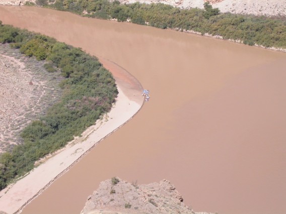
Rafters far below us at the confluence.
On the way back out toward Elephant Hill.
Photos by Ron P.
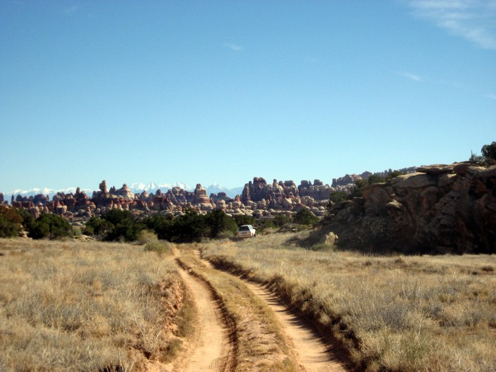
This is really a two-track coming into Canyonlands/Needles from the south.
Needles!.

Good thing the driver can't see this side.

The confluence overlook.
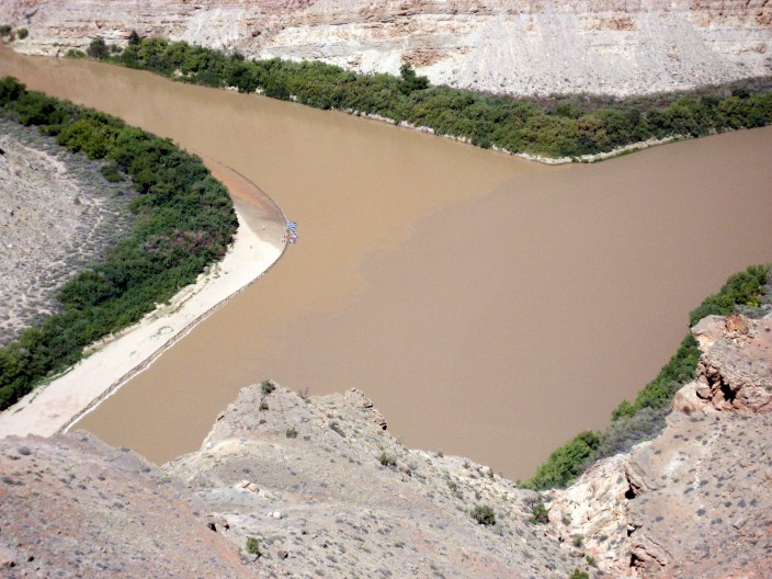
Confluence of the Green River (left) and Colorado River (right).
Climbing Elephant Hill.
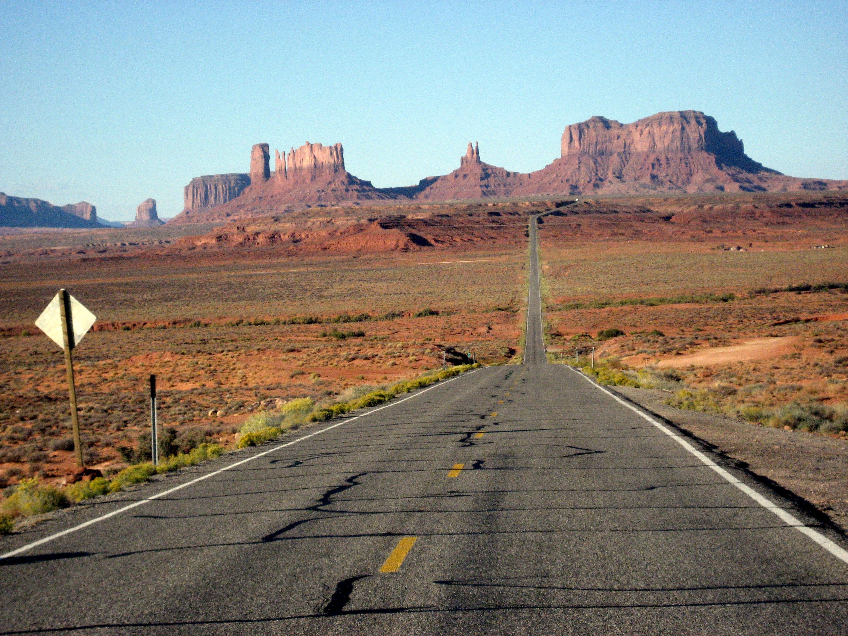
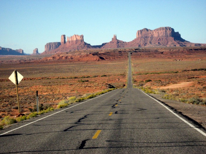
Wednesday, September 27
We spent the night in Blanding and then headed for Tucson. Gateway
Inn had some really fine plumbing after several days of camping. Some
folks had to be back home on Weds afternoon, but the rest of us took
the scenic route. First we stopped for an excellent breakfast at
Goulding's Stagecoach Restaurant in Monument Valley. Then we had a
great time driving across Black Mesa on the Hopi Reservation. First
we had fun looking at the coal mining and reclamation operation on
Black Mesa. Then we stopped briefly at the Hopi Cultural Center near
Second Mesa. A muddy spot on the dirt road allowed us to add Arizona
mud to the Colorado mud and Utah mud already on our trucks.
Photos by John H.
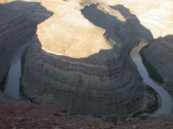
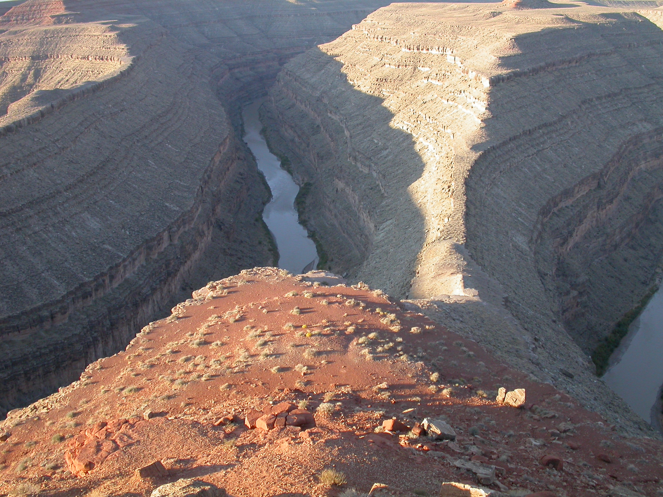
Goosenecks State Park.
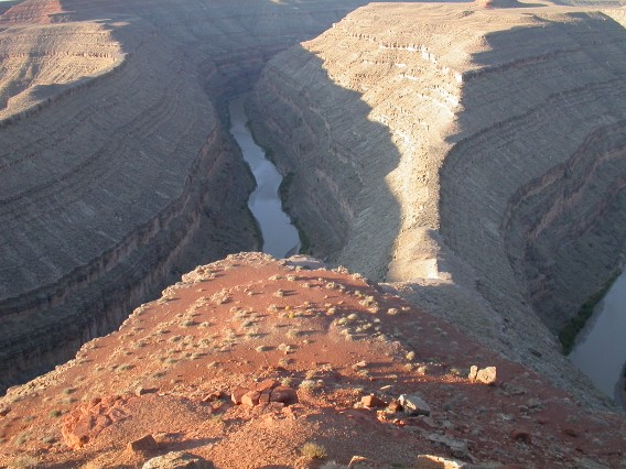
All the Goosenecks don't fit in one photo.
Photos by Ron P.
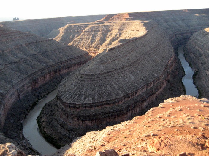
Goosenecks State Park.
Monument Valley.
More photos from 27 September
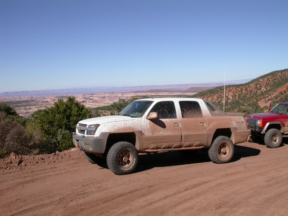
There wasn't any vehicle damage to speak of. I ripped the plastic
cover off my rear bumper in Dark Canyon, and there was the usual
collection of broken antenna wires, stuck latches, etc.. Ed popped a
tire off the bead in the mud, but the tire wasn't damaged. The total
trip was about 1400 miles.
John Hill <jhill@as.arizona.edu>
Last modified: Thu Sep 20 18:44:46 2007